Preservation at Bristoe Station

In Virginia, American Civil War history is never far away.  Battlefields, cemeteries and monuments dot every part of the State. In some communities, population growth encroaches on these historic places and few have any Federal protection as do the battlefields of Manassas or the Wilderness. 

In the 1980’s, development engulfed land in Fairfax County where the Battle of Chantilly was fought in August 1862. A small five acre portion of that battlefield was preserved and can be visited today as Ox Hill Battlefield Park in Fairfax, Virginia. Yet the potential loss of the entire battlefield spurred an organized movement of academics, historians, local governments and private citizens to conserve historic ground. 

Bristoe Station Battlefield Heritage Park is a successful example of this important effort. The park is located in central Prince William County, Virginia, an exurb of Washington, DC, which has seen expansive growth over the past two decades.

Opened in 2007 after an agreement between a local real estate developer, the county and preservationists, the park’s 144 acres encompass rolling hills, open meadows, and stands of evergreen and hardwood trees. With its sweeping vistas and bucolic setting, a visitor might easily imagine themselves in the 1860’s. 

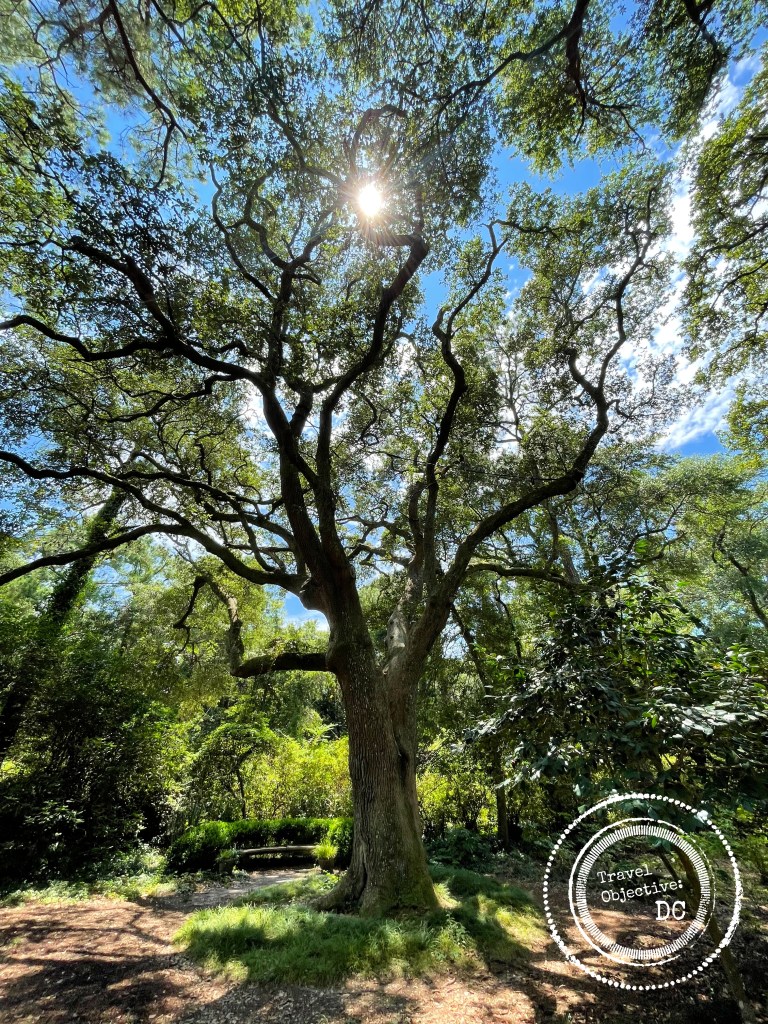
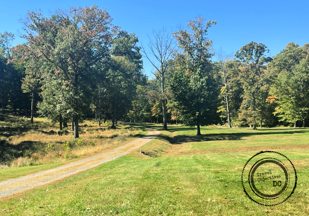
A wooded section of the 1861-1862 Trail at Bristoe Station Battlefield Heritage Park in Prince William County, Virginia.

Railroad tracks border the park and the sounds of train whistles and rumbling railcars are frequent. Fittingly, it was the railroad that first led the northern and southern armies here. Two interpretive trails through the park tell the stories of the troop encampments and bloody engagements that distinguish the park as a historical site worthy of preservation.

The 1861-1862 Trail 

I arrived at the park on a pleasant Sunday morning. A bright October sun powered its way through high, thin clouds. Only a handful of cars were in the parking lot, yet the trails were busy with joggers, bikers and dog walkers. I started my park tour on the aptly named 1861-1862 Trail. The 1.4 mile trail begins off the parking lot, then moves through some of the park’s wooded areas and grassy fields. 

Interpretive signage is plentiful along the trails at Bristoe Station Heritage Park.

Along the trail, interpretive signs describe how after the First Battle of Bull Run in June 1861, rebel units established large bivouac areas around the town of Manassas Junction. Regiments from Alabama, Mississippi, North Carolina, Tennessee and Virginia all had camps in the vicinity of Bristoe Station. 

Unfortunately, the sanitary conditions of the camps were poor and disease rampant, killing many soldiers. Burial details were constant and the graveyards designated by states as well as by regiments.

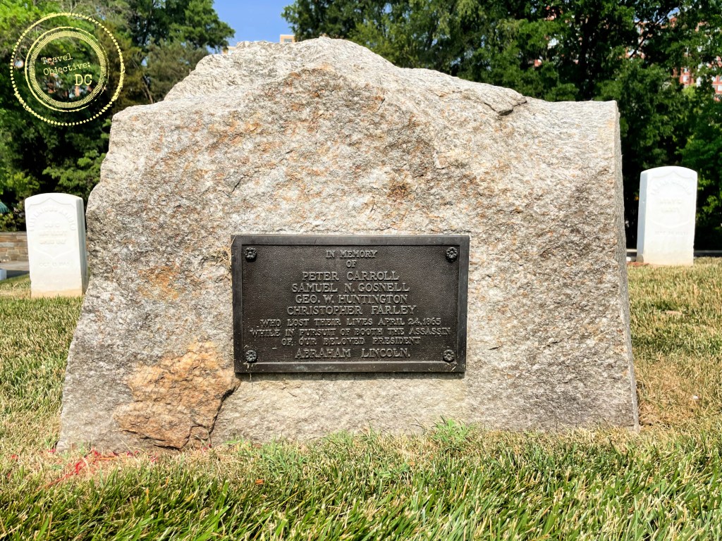
The cemetery of the 10th Alabama Infantry Regiment.

A short spur off the main trail leads to the cemetery of the 10th Alabama Infantry Regiment. 

A small memorial stone and an interpretive sign mark the 10th Alabama’s cemetery in an open area, cleared of brush, under some tall deciduous trees. Early records indicate 82 soldiers may be buried here. While the graves of soldiers from other units are undoubtedly in the park, only the confines of this graveyard have been definitively identified. 

Stone marker at the cemetery of the 10th Alabama Infantry Regiment.

Returning to the main trail from the final resting place of the 10th Alabama’s soldiers, I am led towards areas where portions of the Battle of Kettle Run were fought on August 27, 1862.

The battle was a prelude to the Second Battle of Manassas. In July 1862, Robert E. Lee had just defeated Union General George McClellan and his Army of the Potomac in a series of battles defending Richmond, Virginia. Now Lee was ready to lead an offensive campaign. 

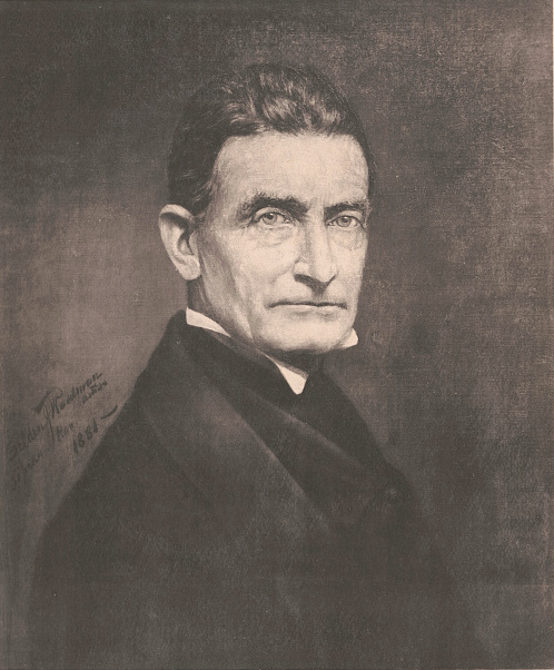
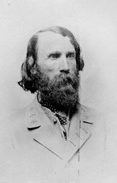
Lee ordered Major General Thomas “Stonewall” Jackson to march north and move around the Army of the Potomac’s right flank. Jackson moved towards Manassas Junction, an important transportation hub and Federal supply depot. As part of his plan, Jackson would cut the Union-held railroad lines at the lightly defended Bristoe Station. 

Major General Thomas “Stonewall” Jackson

Bristoe Station was a stop on the Orange and Alexandria Railroad, which was an important link between the bustling port of Alexandria, Virginia and the settlements of the Shenandoah Valley.

Today’s railroad tracks run along the same ground as in the 1860’s. Modern tracks however, run on the surface of the ground, while in the 19th century, they ran through a narrow conduit dug into the ground.

At Bristoe Station, Jackson’s forces quickly overwhelmed a small contingent of Federal troops. The rebels sabotaged several railcars and left them crosswise on the track.  Before departing for Manassas, Jackson ordered a division under Major General Richard Ewell to remain near Bristoe Station and guard against any further Union action.

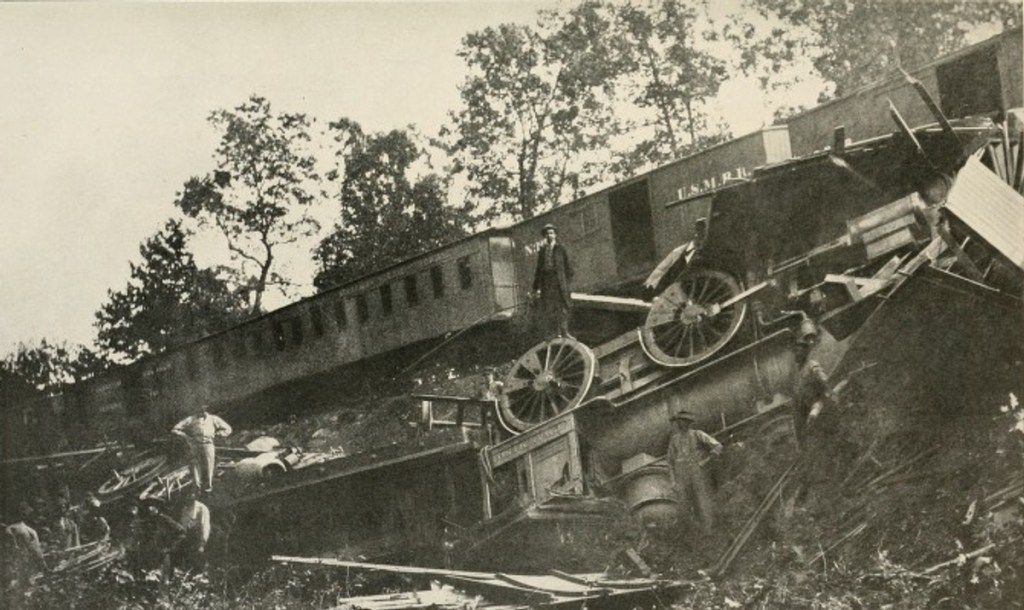
Train derailed by Confederate cavalry on August 26, 1862 

-By Unknown author – File from The Photographic History of The Civil War in Ten Volumes: Volume Four, The Cavalry. The Review of Reviews Co., New York. 1911

Union division commander Major General Joe Hooker had been ordered to move along the rail lines and retake Bristoe Station. His division engaged Ewell’s in a costly battle that stretched from about 2:00 pm until dusk on August 27th. 

The trail progresses through the open field where regiments from New Jersey, New York, and Pennsylvania engaged Georgians and Louisianans. The momentum switched sides several times through the afternoon. The small, but deadly engagement left 330 Union soldiers dead or wounded, while the Confederates suffered 176 casualties. Ewell had accomplished his mission of delaying Union troops. Having received orders from Jackson, he withdrew his forces after dark and and rejoined Jackson north of Manassas. 

The 1861-1862 Trail crossed the field where the Battle of Kettle Run took place. The battle was the opening engagement of the Second Battle of Bull Run.

A little over a year later, these same two armies would return to Bristoe Station for a final engagement. 

After the Battle of Gettysburg in July of 1863, both the Army of Northern Virginia and the Army of the Potomac returned to central Virginia. As the armies refitted, both sides sent significant forces to bolster counterpart armies in the Western Theater of the war. Knowing his enemy was not at full strength, Lee saw an opportunity to attack and defeat a diminished Union enemy. For five days, beginning on October 9, 1863, Robert E. Lee and his counterpart George Meade fought a series of engagements in Virginia’s Piedmont region. Each time Meade evaded Lee’s traps. 

After several days of chasing Meade’s army, Lee’s Third Corps Commander Lieutenant General Ambrose Powell (A.P.) Hill identified a Union force at a distance and ordered three brigades to attack before the Yankees could once again evade him. 

Lieutenant General Ambrose Powell (A.P.) Hill

The 1863 Trail

The second trail, dubbed The 1863 Trail, traces this final action at Bristoe Station on the afternoon of October 14, 1863. The 1.3 mile trail stretches over rolling fields onto a broad grassy slope where a North Carolina brigade commanded by Brigadier General John Cooke attacked the Union line positioned along the railroad tracks. Unfortunately for the Confederates, Hill ordered no reconnaissance mission and did not realize the strength of the Union force. 

After a gallant charge, the brigade was engulfed by heavy artillery and musket fire from well positioned Union troops along the railroad embankment and they hastily retreated back up the slope. 

Subsequent rebel reinforcements could not dislodge the Union line. Under cover of darkness, the Union troops slipped away for more fortified positions around Centreville, Virginia. Although the Southerners commanded the field, the battle had been costly. The Confederates lost 1,400 men who were killed, wounded or captured; men who could not be replaced. Union losses were around 300. Lee had lost his chance to strike an offensive blow against the Army of the Potomac.

“Bury these poor men and let us say no more about it.”

-General Robert E. Lee to Lt. Gen. A.P. Hill

Following the battle, Lee is said to have dismissed Hill’s explanations for the loss saying, “Bury these poor men and let us say no more about it”.

The Bristoe Station Battlefield Heritage Park is maintained by the Prince William County Parks, Recreation, & Tourism, Office of Historic Preservation. Staff members and volunteers offer tours of the park on designated weekends in the spring and summer. The site also hosts periodic reenactments and living history programs. 

While the battles fought at Bristoe Station were not as large nor as well known as other Civil War engagements, they were important pieces of two significant Civil War campaigns. A visit here provides important insights into how the two battles of Bull Run developed and how their outcomes impacted both armies. 

Uniformed reenactors depict a portion of the 1863 Battle of Bristoe Station.

Bristoe Station is a tremendous example of the many benefits of successful preservation efforts. The park allows present and future generations to learn from the past and enjoy a natural setting amongst the tangle of suburban development. 

Although the immediate park is preserved, the pressure to develop near historic sites in Virginia, including Bristoe Staton remains strong. Even now a large project to build data centers and warehouses on neighboring properties where portions of the 1863 battle took place threatens sight lines and will bring increased noise and traffic to the area. 

Preservationists are pursuing a variety of measures to balance development around the park and throughout the region, raising funds to purchase historic properties, filing petitions and engaging with public officials. Success can be elusive, but areas such as Bristoe Station represent an irreplaceable part of our heritage.

So the “third battle” of Bristoe Station–to keep the area’s natural setting–continues.

* * *

Route Recon

The main parking lot for Bristoe Station Battlefield Heritage Park is located at the intersection of Iron Brigade Avenue and 10th Alabama Way, Bristow, Virginia, 20136.

From Interstate 95: Take Rt. 234 North (Exit 152B); travel 7.5 miles and make a left onto Independent Hill Drive. Then make your immediate right onto Rt. 619 (Bristow Road). Travel 7 miles and turn left onto Iron Brigade Unit Avenue. The parking lot is located on your left at the traffic circle.

From Interstate 66: Take Rt. 234 South (Exit 44). Travel 4.5 miles and turn right onto Rt. 28 (Nokesville Road). Travel 1.5 miles and turn left onto Rt. 619 (Bristow Road). Travel .25 miles and turn right onto Iron Brigade Unit Avenue. The parking lot is located on your left at the traffic circle.

The 140+ acre suburban park has more than 2.7 miles of walking and equestrian trails.

NOTE: There are NO restroom facilities at the park. 

Click here for a trail map. 

Guided Tours are offered May-October on the second and fourth weekends of each month. Visit the Prince William County Parks, Recreation and Tourism, Office of Historic Preservation website for more information. 

Prince William County has curated a driving tour of regional landmarks related to the entire Bristoe Station Campaign of October 1863. Visit the website for more information. 

Walking Through History at Fort Washington

On a hot summer day, five authentically dressed men reenact a 19th century US Army artillery detail. The solider in charge of the detail, or gunner, calls the commands while the cannoneers crisply and meticulously execute the drill. The highly polished barrel of the M1841 mountain howitzer shines brightly in the sun. The gunner shouts the final command: Fire! A cannoneer pulls the lanyard, a spark ignites the powder charge within the cannon. Brilliant flashes of flame shoot from the breech of the cannon’s barrel.  Booms echo off the brick walls while smoke fills the sultry air.

National Park Service volunteers reenact a 19th century cannon drill at Fort Washington.

The reenactors are National Park Service volunteers demonstrating the skills of artillery soldiers at Fort Washington Park in suburban Prince George’s County, Maryland, just east of Washington, DC. Mention Fort Washington Park to an area resident and you are likely to get a blank stare or a vague reference to the local neighborhood of the same name. Many are unaware of this national park, hugging the eastern shore of the Potomac River just south of Alexandria, Virginia. Indeed, a recent sunny day found mostly local residents visiting the park, jogging, walking dogs and biking along the park’s avenues and trails. 

The story of Fort Washington is really the story of four different forts spanning almost 140 years. The first three of which were built specifically to defend Washington, DC from an enemy naval attack via the Potomac River. In today’s era of jet aircraft and precision guided missiles, we do not think much about coastal defense. Yet in the first 150 years of the United States, it was an important strategic and sometimes political issue. 

The Fort Washington Park Visitor Center building was originally the post commander’s quarters. It dates from 1822.

The Fort Washington Park Visitor Center is the worthwhile first stop for new visitors to Fort Washington.  Housed in the original post commander’s quarters, the visitor center provides helpful background on how America’s approach to coastal defense changed through history. Displays detail nearly 140 years of Army life at Fort Washington, describing the four different forts, the various weapons deployed as well as the different Army units posted here. Make sure to step out onto the back deck. The commanding views of the Potomac River reveal why this location was selected for Washington, DC’s defense. 

Near the visitor center, two concrete relics are reminders of the “third” Fort Washington. After the Civil War, the world’s navies began building warships with iron and steel, rather than wood. In the 1880’s, the Army developed the Endicott System for coastal defense which included concrete structures and rifled guns and other armaments that could penetrate the armored plating of these new combat vessels. 

The present day ruins of Decatur Bunker.

Between 1891 and 1902 the Army built a series of eight concrete bunkers around Fort Washington to position these weapons. Adjoining the parking lot is Decatur Bunker. While today is looks like a set for a post-Apocalyptic movie, it was originally built to house two 10-inch “disappearing guns” named because the cannons would drop down behind the bunker wall after firing, allowing for safe reloading. 

The bunkers were electrified and had telephones connected to a central tower where an officer directed the fire of the batteries as necessary. The Fire Control Tower is located right next to the visitor center.  Although the bunkers are visible, they are fenced off and entry is prohibited. However, similar Endicott System bunkers across the Potomac River at nearby Fort Hunt in Virginia are open for public exploration.   

The Fire Control Tower

A short walk from the visitor center is the “second” Fort Washington, the main attraction at Fort Washington Park today. Built after the War of 1812, it was finished in 1824, but largely unused until a renovation in the 1840’s allowed the fort to be sufficiently armed. 

Approaching the main gatehouse with a dry moat and large drawbridge, the fort feels almost medieval. But it really is the product of careful military engineering reflecting the defensive technology and combat tactics of the time. The fort is distinctive as one of the few remaining coastal fortifications in its original form.

Designed to thwart attacks by land as well as by water, the fort’s massive brick walls have many angles and turns so defending solders could have multiple positions to fire on attackers. Parapets on the western wall facing the river provided firing positions for the sizable cannons to engage enemy ships. Several types of cannons in use at the fort are on display, including an original 24-pounder cannon so named because the solid cannonballs it fired weighed 24 pounds (with a range of 1900 yards)! 

The parade field at Fort Washington. Note the enlisted barracks building on the left and the 24 pounder cannon on the right.

A large parade field dominates the interior of the fort. The parade field was a center of daily life for the soldiers. Here troops would parade, stand inspections, answer daily roll calls, organize work parties, and conduct drills.  Adjoining the parade field are two long brick buildings, one housed officers and their families, the other was the enlisted barracks.  

A left turn down the hill from the fort’s main gate leads to the river and an area known as Digges Point. In the century before the Army built fortresses on this ground, the Digges family, transplants from Virginia, maintained a tobacco plantation named Warburton on today’s parkland. Thomas Digges was a contemporary and friend of his neighbor George Washington. George and Martha Washington regularly visited Warburton, traveling by riverboat from Mount Vernon and disembarking at Digges Point. A US Coast Guard channel marker stands in the area today.

The Potomac River looking south from Fort Washington.

As concern about another war with Britain continued growing in the early 1800’s, Congress allocated money for a system of fortifications to protect the Eastern Seaboard. The Army built the first fort near Digges Point in 1809. Originally known as Fort Warburton, it had 14-foot-high brick walls and up to 26 cannons. 

Unfortunately, Fort Warburton did not fare well in its first and only engagement. On August 27, 1814, a ten ship Royal Navy flotilla sailed up with Potomac River towards Alexandria. A day earlier, Washington, DC had been attacked and burned by other British forces. With only enough soldiers to crew five cannons, and sensing defeat, the fort’s commander, Captain Samuel Dyson took drastic action.

He ordered the cannons be destroyed, the magazine with all its black powder blown up, and the garrison to withdraw. The magazine’s explosion left most of the fort heavily damaged before Royal Navy guns destroyed the rest. Not surprisingly, Captain Dyson’s chain of command considered this a very poor decision. He was courtmartialed and dismissed from the Army. There is not much of the original fort remaining today, but its original location on a grassy, level piece of ground near Digges Point is evident.

The introduction of the airplane in World War I made the idea of large forts with cannon for coastal defense obsolete. In the decades following the war, the fourth Fort Washington served as a garrison for the 3rd Battalion, 12th Infantry Regiment, the Army’s ceremonial unit (a role played by the 3rd Infantry Regiment today). During World War II, the Adjutant General Corps located its training school at Fort Washington and the 67th Women’s Army Auxiliary Corps detachment also called it home.  

There are few remaining buildings from this time. In 1946, Fort Washington was turned over to the Department of the Interior to become a national park and over 300 buildings were removed.

This brick building served as a post exchange and gymnasium. It is one of the few surviving buildings at Fort Washington from the 20th Century.

With the soldiers long departed, Fort Washington’s mission today is to provide a place for recreation. Beyond history, the park’s expansive green spaces and proximity to the water provide a unique natural setting. Several walking trails traverse the grounds with varied habitats. Bird and wildlife are abundant. Watch for deer, foxes, and raccoons. In the open areas, a variety of songbirds can be observed while bald eagles, osprey, herons, and mallards are seen along the river. Fishing is an option as well with dozens of fish species in the adjoining waters. 

While the Washington region teams with many significant sites in US military history, Fort Washington is unique. Where other sites are related to a single event or era, Fort Washington chronicles the period from wooden ships to World War II. A “must see” for those interested in defensive fortifications, Fort Washington is also a most pleasant place to spend some quiet time on the Potomac River. So, pack a picnic, bring your binoculars for the views, and walk through some history at Fort Washington. 

* * *

Route Recon

The Fort Washington Park Visitor Center and the historic fort are open Thursday – Sunday from 9:00 am – 4:30 pm, except on Christmas and New Year’s Day. The Visitor Center and historic fort are closed on Monday, Tuesday and Wednesday. 

The park grounds are open through sunset each day. From October – April, park grounds open at 8:30 am. From May – September, park grounds open at 6:30 am. 

Fort Washington hosts living history as well as conservation programs on a recurring basis. Check the Fort Washington Park website for more information and schedules.  

There is no charge to visit Fort Washington. 

A State of Maryland fishing license is required to fish at Fort Washington. 

Fort Raleigh National Historic Site, Where History Abounds on the Outer Banks

In 1590, Captain John White eagerly sailed from England anxious to return his family and friends living on Roanoke Island, a barrier island part of today’s Outer Banks of North Carolina. Due to a war with Spain, three long years had passed since his departure to procure additional resources for the fledging settlement. Upon his return however, he found the dwellings and working areas abandoned. There were no signs of the English settlers.  The only clues were two inscriptions; CROATAN on a wooden post and CRO carved into a tree. White never learned what happened to his community and the search for their fate continues today.

An engraving from the 1870’s depicting Captain John White’s return to the Roanoke Colony.

-Design by William Sheppard; engraving by William James Linton.

Modern  visitors to Roanoke Island can learn more about the “Lost Colony” at the Fort Raleigh National Historic Site, located on the northern end of Roanoke Island, near Manteo, North Carolina. The site’s large open green spaces and broad ribbons of wooded areas are a stark contrast to the sand of the Outer Bank’s renowned beaches.  

Fort Raleigh was designated a historic site in 1941 after archeological evidence confirmed the English colonists once occupied a portion of the land. Today there is a modern visitor center, renovated in 2015, with exhibits about the history, archeology and artifacts of the early settlement. Some recent discoveries include fragments from ointment containers, olive jars and indigenous pottery. 

Reproductions of maps and illustrations drawn by Captain John White hang on the historical wood paneling in the Elizabethan Room.

An “Elizabethan Room” within the visitor center is decorated with intricately carved wood paneling from an actual Elizabethan-era English manor house. The room features an innovative electronic display that dramatizes the circumstances and conversations of Roanoke Colony leaders, investors and settlers. The scenes offer some intriguing insights into Captain John White’s intent to leave England for North America and his hopes for the future. A 17-minute film in the visitor center theater provides additional context on the settlers’ lives. A reconstructed earthen fort depicting the original Fort Raleigh’s walls lies a short walk from the visitor center. 

Although it did not happen on the grounds of Fort Raleigh, the National Historic Site also interprets the story of the Civil War Battle of Roanoke Island, an early and strategic Union victory during a time when Confederate forces appeared ascendant.  

US Army Brigadier General Ambrose Burnside won a decisive victory on Roanoke Island in February 1862.

After Federal losses in 1861, Union strategists and planners identified the thinly defended North Carolina coast for a military operation.  Roanoke Island was identified as the principal objective. If Roanoke Island could be taken, then shipping to and from the port cities along the North Carolina coast and Norfolk, Virginia could be blocked. Union Brigadier General Ambrose Burnside, with the support of his boss Major General George McClellan, began assembling a “coast division” capable of landing on and occupying Roanoke Island. The division would then establish a foothold for further action in eastern North Carolina. 

Burnside recruited 14 infantry regiments (approximately 13,000 troops) for his division. He also contracted a large fleet of private commercial ships to transport his troops. In an early example of a joint forces’ operation, Burnside coordinated closely with US Navy Flag Officer Louis Goldsborough. Goldsborough’s flotilla would subdue Confederate warships and pepper coastal fortifications with covering fire in advance of Burnside’s ground operations.    

View of Ashby’s Harbor looking west, where Union forces landed on Roanoke Island.

Through the afternoon and into the evening of February 7, 1862, the Union Army landed 11,500 men at Ashby’s Harbor, on the western side of Roanoke Island. This was one of the US Army’s first amphibious operations in hostile terriroty. After a rainy night, the division’s three brigades marched east through swampy and difficult terrain. 

Confederate forces established their defensive line along the island’s main road to the northeast, centering it on a battery of three field guns.  As Union brigades deployed, they attacked the Confederates on the left, right and the center. The rebels were soon overwhelmed and withdrew to the north. However, with no way to leave the island, they ultimately surrendered. The Union Army captured over 2,500 soldiers along with 42 artillery pieces and large quantity of small arms.  

After taking Roanoke Island, Burnside then moved against other port cities through the spring. By summer, the cities of New Bern, Beaufort, Fort Macon and even Norfolk, Va., had all fallen to Union forces. 

Battle of Roanoke Island historical marker.

Another significant outcome of the battle was a surge in the African American population on Roanoke Island. Considered “Contraband of War” by the Army, enslaved African Americans were emancipated as they entered Union controlled territory. As the numbers of arriving African Americans steadily rose, the Army confiscated local land to provide an area for the newly freedmen to settle and established a Freedmen’s Colony in 1862.    

A chaplain from the 25th Massachusetts Volunteer Infantry Regiment named Horace James was placed in charge of the colony. Reverend James was a skilled organizer and administrator, focusing the colony’s efforts on supporting the Union Army.  In exchange for rations and wages, newly freed African Americans worked in a variety of jobs such as carpenters, blacksmiths, stevedores, fishermen, or as domestic staff. The more daring served as scouts, spies and guides, gathering critical intelligence and accomplishing important missions.

This stone memorial was placed at the Fort Raleigh National Historic Site to commemorate the Freedmen’s Colony.

During the war, the colony kept growing with a total population reaching almost 4,000 at its peak. A lumber mill was built, along with schools, churches and over 500 houses. After the war though, Federal policy returned impounded lands back to the original owners. Most of the freedmen moved away, although some remained. The colony was officially dissolved in 1867. Today a granite marker at the historic site commemorates the Freedmen’s Colony and the refuge it provided on Roanoke Island. 

The attraction of Fort Raleigh is more than its displays and stories of the past. Indeed history on Roanoke Island is kept very much alive. 

Adjoining Fort Raleigh is the Elizabethan Gardens, an initiative of the Garden Club of North Carolina. The brick gatehouse serves as a portal to a collection of different types of gardens inspired by the Elizabethan era and beautifully arranged over ten lush acres. 

The garden’s design combines trees, shrubs and flowering plants carefully selected and placed so that seasonal variations result in a constantly changing appearance. Italian statuary from the Renaissance period is displayed throughout the gardens adding to the classical look and feel. One of the garden’s main features is a massive 400-year-old oak, a living connection to the earliest English colonial times and the four and a half centuries that followed.  

An ancient oak tree in the Elizabethan Gardens which grew during the times of the “Lost Colony”.

Forth Raleigh also houses the Waterside Theater, home of the long running production of The Lost Colony. Now in its 86th season, the outdoor play is one of the most prominent cultural experiences on the Outer Banks. More than just a drama, the story of the early English settlers is told with music and dancing, along with comedy, fight scenes and a dash of English pageantry. 

Although it has seen some modifications through the years, the Roanoke Island Historical Society, producer of The Lost Colony, used the pause due to the recent pandemic to rework portions of the production. A special focus was the portrayal of Native Americans. The Historical Society worked with the local Lumbee tribe to ensure the Native American characters’ dialogue and dance scenes are accurate. Additionally, all actors playing Native Americans on stage have indigenous heritage.  More modern staging effects have also been incorporated; 3-D images projected onto the stage sets provide very realistic backdrops to scenes set in gardens, forests and onboard ship. Audiences have enthusiastically returned, keeping The Lost Colony an Outer Banks tradition.  

Each year millions of people visit the Outer Banks. They come for the beach life, water sports, ocean breezes and the wild horses on Corolla. Some also come for the history, as history abounds on the Outer Banks. They come for stories of the Wright Brothers, pirates and the U.S Live Saving Service. Add some history to your Outer Banks trip with a visit to the Fort Raleigh National Historic Site, where Outer Banks history is carefully preserved and made relevant for today.

* * *

Route Recon

Fort Raleigh National Historic Site is located on the north end of Roanoke Island, about four miles north of the town of Manteo, North Carolina. The Visitor Center address is 1500 Fort Raleigh Road, Manteo, North Carolina 27954. The phone number is 252 473-2111. Call ahead for information on daily historical talks.

The Elizabethan Gardens is located at the Fort Raleigh National Historic Site. The address is 1411 National Park Drive, Manteo, North Carolina 27954. The gardens are also a short walk from the Fort Raleigh Visitor Center. Visit the Elizabethan Gardens website for more information, including current admissions rates.

The Waterside Theater, home of the The Lost Colony production, is located at 1409 National Park Drive, Manteo, North Carolina 27954. Visit The Lost Colony for more information on scheduling and ticket pricing.

Ashby’s Harbor is located at the end of Skyco Road about 4.5 miles from the Fort Raleigh National Historic Site. From the Visitor Center, head south on US Route 64 past the village of Manteo. Continue straight at the intersection with North Carolina Route 345. After .7 miles, make a right onto Skyco Road.

The Historical Marker for the Battle of Roanoke Island is located on the southeast corner of the intersection of US Route 64 and North Carolina Route 345. There is a small parking area on the southside of the intersection. This is a busy intersection so use caution when viewing the marker.

Mess Call

The Hungry Pelican is a local Manteo deli offering excellent sandwiches as well as salads, ice cream and great desserts. The Hungry Pelican is located at 205 Budleigh Street in the historic center of Manteo. Visit their website for menus and operating times.

Keeping Alexandria National Cemetery “A Sacred Grove”

In late April 1865, a manhunt was underway across the Mid-Atlantic for John Wilkes Booth. To prevent President Lincoln’s assassin from crossing the Potomac River into Virginia, the US Army’s Quartermaster Department contracted a coal barge, the Black Diamond to augment a larger river flotilla hunting for Booth.   

In the very early morning of April 24, the Black Diamond tragically collided with another private vessel, Massachusetts, which was contracted to transport soldiers from Alexandria, Virginia to Fort Monroe in the Hampton Roads area. Eighty-seven men were lost. This included four civilian firefighters employed by the Quartermaster Department who had volunteered to help crew the Black Diamond on its important mission. As they died in service to their country, the four civilians from Alexandria, Virginia, were conferred the honor of being buried alongside deceased Union soldiers in a new type of burial ground, the Alexandria National Cemetery. 

Today, the Alexandria National Cemetery is found within the Wilkes Street Cemetery Complex, an expansive 82-acre area encompassing over a dozen different community cemeteries in Old Town Alexandria. A red sandstone wall, stately iron gate and nearly uniform white stone gravestones arrayed in neat lines distinguish this cemetery from its neighbors.  

While national cemeteries are not unique to the United States, for over one hundred fifty years our government has devoted significant resources and attention to the dignified burial of its war dead and  military veterans. The advent of national cemeteries in the United States came at the beginning of the Civil War as the need for the Federal Government to maintain its own cemeteries became apparent. Large numbers of men were quickly joining the Army’s ranks. Equally fast, the terrible cost of war was realized. Soldiers were lost in battles or died of combat related wounds. Diseases and accidents killed even more. Past practices of local burials in private cemeteries or returning soldiers’ remains to families were no longer feasible. 

As a first step, in September 1861 the Quartermaster Department recorded where soldiers were being buried and provided wooden grave markers.  In July 1862, Congress directed the president to acquire appropriate grounds for “a national cemetery for the soldiers who shall die in the service of the country”. 

The Alexandria National Cemetery was established in 1862, two years before Arlington National Cemetery.

The early cemeteries were established near Army camps and training centers.  At the time, Alexandria was an important logistical hub, supply depot, and training area for the Union Army. The city also anchored the southern defenses of Washington, DC, (as seen today at nearby Fort Ward Museum and Historic Site) and operated multiple Union Army hospitals around the city. In 1862, the Army established a cemetery on four acres of local land already accommodating other graveyards, one of the first fourteen national cemeteries. Sadly, the cemetery filled quickly, even after a small expansion. By 1864, the Army began looking for other grounds for burials in the Washington area, leading to the establishment of today’s well known Arlington National Cemetery. 

Following the war, the Quartermaster Department began a massive multiyear project for identifying, excavating and reinterring soldier’s remains in additional newly established national cemeteries. By 1871, there were approximately 300,000 reinternments into more than 70 national cemeteries across the United States. This was the first time any nation undertook such an effort to bury its war dead. At first, only those who died on active service were allowed burial in a national cemetery. However, Civil War veterans wanted to be buried with their deceased comrades and Congress ultimately authorized burials for all honorably discharged veterans. 

Successive Congressional legislation authorized funds for marble headstones, walls, gates and structures to be built on cemetery grounds in an effort to keep the cemeteries simple yet stately. The famous landscape architect Frederick Law Olmsted recommended a national cemetery be kept modest with “permanent dignity and tranquility … a sacred grove”. 

Today, the Alexandria National Cemetery remains a fine example of an early national cemetery aligning with Olmstead’s vision. Despite the cemetery’s urban location, it remains a quiet setting, save for airplanes coming and going from Reagan National Airport. A handsome brownstone building stands to the left of the main entrance marked by the ornate cast-iron gate found at the end of Wilkes Avenue.

The lodge was originally built as a cemetery superintendent’s home and office.

The building is based upon a design by architect Edward Clark and approved by Montgomery Miegs, the Quartermaster General of the Army during the Civil War. The design became known as the “Miegs Plan” and the buildings were intended for use as a superintendent’s home and office. Clark designed these lodges in the French Second Empire style using locally quarried Seneca sandstone to resemble other fashionable dwellings and office buildings built during this time. 

Only about twenty of these structures remain in national cemeteries today. The building currently houses office space and meeting rooms. A paper bound directory on the building’s porch assists visitors in locating specific graves. A redbrick annex at the back of the building is a converted restroom from the 1880s. 

Approximately 4,000 white stone markers spread out in orderly rows over the carefully manicured acres. The cemetery is currently closed to new internments (save for veterans or family members to be buried in an existing grave).

A paved roadway circumvents a central flagpole, flying the US flag. The graves of the four civilian firefighters who perished aboard the Black Diamond lie near the flagpole; a granite monument to their memory was added in 1922. 

A marble platform with a podium and seating area replaced an older cast iron version in the 1940s. Meant for internment ceremonies, it is often used today for Memorial Day services. It is a convenient spot for pausing and contemplating the stories and sacrifices of those buried around you.  After spending some time on the grounds, it is clear that while the Alexandria National Cemetery is not as large nor renowned as its regional neighbor in Arlington, it is still a very active civic space for the people of Alexandria.

The Marble Rostrum

The grounds are perpetually cared for and remain neat and tidy. Walkers, joggers and bikers respectfully traverse the grounds, sometimes personally cleaning and tending to the stones. Visitors seek out specific graves, paying respects and leaving the occasional memento. Veterans groups meet at the lodge, planning their activities. Each Memorial Day, US flags are dutifully placed on the graves. Each December, evergreen wreaths grace the headstones. 

Through successive wars, the American custom continues of providing war dead, veterans and certain family members with a dignified burial in well-arranged cemeteries. Much of this work is done through volunteers who devote time and energy to enhance their community’s national cemetery. You can help keep this tradition alive and ensure your local national cemetery remains and active part of the community.

There are currently 171 national cemeteries in the United States and its territories managed by various federal agencies. All of them welcome volunteers to maintain these “sacred groves” as dignified and respectful burial grounds. Duties vary by location and range from administrative support, attending funerals, planning events and grounds work.

Volunteering At A National Cemetery

Of the 171 national cemeteries in the United States and its territories, 151 are administered by the Department of Veterans Affairs, 14 are managed by the National Park Service, and two by the Department of the Army. Internationally, 26 national cemeteries are managed by the American Battlefield Monuments Commission. 

More information on volunteering at national cemeteries can be found here:

Visit individual NPS National Cemetery websites for specific volunteer information.

ANC routinely looks for volunteers to collect wreaths following the the annual Wreaths Across America observance. Check the ANC website each December for more information. Other volunteer opportunities may occur through the year.

Route Recon

By car:

The Alexandria National Cemetery is located at 1450 Wilkes Street in Alexandria, Virginia. The gates to the cemetery are located at the end of Wilkes Street. 

There is parking along Wilkes Street. 

By public transportation:

The closest Washington DC area Metro Stop is King Street Metro Station. Take the DASH Bus #31 towards Braddock Road Metro. Exit the bus at the corner of King Street and Fayette Street. The cemetery gates are a .6 mile walk from this bus stop. Walk south on Fayette Street, then make a right onto Wilkes Street. The cemetery is at the end of the street. 

Alternatively, take the King Street Trolly from the King Street Metro Station. Disembark at West and King Streets. Walk one block east on King to Payne Street. Walk four blocks south on South Payne Street to Wilkes Street. Make a right on Wilkes Street. The cemetery is at the end of the street.

While at Arlington, “Remember the Maine!”

“Remember the Maine, to Hell with Spain” became a rallying cry for war in the spring of 1898. As a simmering independence movement in Cuba was becoming increasingly violent that January, President William McKinley sent the USS Maine to Havana to watch after American lives as well as political and business interests. Tensions between the United States and Spain had been growing over independence movements in Cuba, Puerto Rico and the Philippines; McKinley was hoping for a peaceful resolution.

The USS Maine circa 1895-1898

-US Naval History and Heritage Command Photograph

However, it was not to be. The Maine arrived in Havana on January 25th with approximately 26 officers, 290 sailors and 39 Marines on board. Just after the bugle call Taps on February 15th, an explosion detonated the five tons of gunpowder charges for the Maine’s large guns. The forward section of the ship, containing the enlisted men’s quarters, blew apart. An estimated 266 men died either during the explosion or in the days afterward.

The USS Maine Memorial at Arlington National Cemetery

How the explosion occurred was not immediately apparent. Several different investigations and reviews could not concur on a definitive cause. Though the combustion of coal dust was one possibility, several prominent newspapers of the time blamed a Spanish naval mine. A vocal element of the population was ready to use force against Spain and Congress declared war on April 25th. The war would end quickly and favorably for the United States as Spain ceded Guam, Puerto Rico and the Philippines. 

Even with the war’s prompt conclusion, America did not forget about the Maine. In 1899, the remains of 165 sailors who died in the explosion were exhumed from a Cuban graveyard and reinterred at Arlington National Cemetery.  In 1912, the Army Corps of Engineers recovered the twisted remains of the Maine’s hull from Havana Harbor and towed her further away from the Cuban coast. After recovering an additional 66 bodies, the Maine was then scuttled in deeper waters while Taps played and escort ships offered a 21-gun salute. The ship’s masts were salvaged and the main mast sent to Arlington National Cemetery. 

The mast of the USS Maine passes through the stone structure and is embedded into the floor. A surviving piece of the ship’s bell is hung on the front door.

Efforts to build a memorial to the Maine began shortly after the explosion and about twenty monuments or special exhibits of the ship’s artifacts exist around the United States. President Woodrow Wilson dedicated the current memorial at Arlington National Cemetery in 1915, adjoining the burial site of the USS Maine sailors. The centerpiece of the memorial is a circular stone structure, 90 feet in diameter, built around the ship’s main mast. The shape of the structure suggests the warship’s gun turret, but it also has served as a temporary mausoleum. Rigging extends from the top of the structure up to a crow’s next atop the mast. On the circumference of the building are names and ratings of the sailors who died in the explosion. The front door of the structure holds a piece of the ship’s bell, which was broken in half during the explosion. 

A paved lane encircles the memorial. To the east is an anchor made specifically for the memorial but resembling the anchor onboard the Maine.  Positioned along the back of the memorial are two bronze Spanish mortars, cast in the 1700s and captured by Admiral George Dewey in the Philippines during the Spanish–American War. 

The replica anchor was the centerpiece of an earlier memorial to the USS Maine. It weighs about two tons.

Most auspiciously, in the twelve decades since that fateful February night, the USS Maine is still not forgotten. There have been periodic reinvestigations and new studies into the cause of her sinking, reexamining the available evidence and using modern technologies and computer simulations. In 2000, a marine exploration firm unexpectedly came upon her wreck at a depth of 4,000 feet. Yet a definitive cause of the explosion remains elusive.

Next to the USS Maine Memorial, Section 24 at Arlington National Cemetery contains the graves of 229 sailors lost on the USS Maine.

Fortunately, any visitor to Arlington National Cemetery can also “Remember the Maine”. A short walk from the Tomb of the Unknown Soldier will lead to the USS Maine memorial.  Observe the neatly organized graves and note the names along the memorial’s wall.

Their sacrifice endures.  

* * *

Route Recon

Arlington National Cemetery is open daily from 8:00 am to 5:00 pm. 

Arlington National Cemetery is located across the Potomac River from Washington, D.C. at the end of Memorial Avenue, which extends from Memorial Bridge. Arlington is accessible from the major roadways in the D.C. area: Interstate 95, the Capital Beltway (I-495), and the George Washington Memorial Parkway.

Parking: A parking garage is located near the cemetery’s entrance on Memorial Avenue.

Metro: Arlington Cemetery station is stop on the Washington Metropolitan Area Transit Authority Blue Line.

Both the Parking Garage and Metro station are a short walk from the Welcome Center. Please note there is a 100% security check for visitors entering the cemetery.

The USS Maine Memorial is located to the west of the Tomb of the Unknown Soldier and the Memorial Amphitheater. You can view a map of Arlington National Cemetery here.

Cleared for Takeoff at the Steven F. Udvar-Hazy Center

The sliding glass doors retract and beckon you inside.  Passing the metal detectors, navy blue jacketed security officers nod a quiet greeting. Walk through a cavernous entryway and on to a balcony overlooking the massive Boeing Hanger. On the gallery floor the world’s fastest jet powered aircraft, the SR-71 Blackbird stares back at you, sleek and silent.  On the left, the toothy grin nose art of a P-40 Kitty Hawk welcomes you while an F4U Corsair dips its bent wing in a friendly gesture as if to say, “We’re glad you’re here, but you better get started. There is a lot to see!” Indeed, within the Steven F. Udvar-Hazy Center’s hangers are the products and byproducts of over two hundred years of aviation history. 

For anyone interested in aviation and space exploration, it doesn’t get much better than this.

For most visitors to the Washington DC area, the Smithsonian Institute’s National Air and Space Museum is synonymous with the building on the National Mall.  Currently undergoing renovation, that museum building can only hold a small portion of the Smithsonian Institute’s massive collection of artifacts and materials related to aviation and space travel. 

A US Coast Guard Sikorsky HH-52A Seaguard Helicopter

The Steven F. Udvar-Hazy Center is the other main component of the Smithsonian Institute’s National Air and Space Museum. Located in Chantilly, Virginia, it adjoins Washington Dulles International Airport. Conceived as additional space for the display of the Smithsonian’s extensive collection of aviation and space travel artifacts, it opened to the public in 2003. Between the National Air and Space Museum’s building on the National Mall and the Udvar-Hazy Center, approximately 80 percent large aircraft and spacecraft from the Smithsonian’s holdings are on display.

The center’s namesake Steven F. Udvar-Hazy is a Hungarian-born immigrant who came to the United States in 1958. A lifelong lover of aviation, Udvar-Hazy eventually became chairman of the International Lease Finance Corporation, one of the world’s largest aircraft leasing firms. He donated $66 million of his personal fortune to the Smithsonian for the purposes of building this impressive facility with its three main galleries: the Boeing Aviation Hanger, the James McDonnell Space Hanger and the Mary Barker Engen Restoration Hanger.  

The Boeing Gallery boasts nearly 200 aircraft in a space comparable to the flight deck on a Nimitz-class aircraft carrier.  Curators very carefully arranged the aircraft to maximize the available display space within the hanger. Organized into collections, the aircraft are situated either on the hanger floor or suspended from the ceiling. Balconies on multiple levels help visitors to see the meticulously restored aircraft up close.

The Air France Concorde FA, within the south side of the Boeing Hanger at the Udvar-Hazy Center.

The Udvar-Hazy Center features tours most days. Over 60 to 90 minutes, the volunteer docents lead visitors around the World War I fighters and reconnaissance aircraft, inter-war trainers and prototypes, Allies and Axis aircraft from World War II, early passenger airliners, experimental aircraft, general aviation planes, Cold War jets, helicopters and more. Some of the highlights of the collection include:

SR-71 Blackbird – The SR-71 is the fastest jet engine propelled aircraft. First flown in 1964, the operational performance and technological sophistication of the Blackbird is still impressive today. The centerpiece of the Boeing Gallery, the SR-71 Blackbird on display logged about 2,800 hours of flight time over 24 years. The U.S. Air Force donated this Blackbird to the Smithsonian. On its final flight, the Blackbird set a speed record flying from Los Angeles to Washington-Dulles International Airport in 1 hour, 4 minutes, and 20 seconds (about 2,124 miles per hour) 

B-29 Enola Gay – The Boeing B-29 Superfortress was first conceived in the 1930s as bomber with a greater range and capacity than the B-17. The B-29’s extended range of about 4,000 miles when loaded made it especially suitable for use in the Pacific Theater during World War II. On August 6, 1945, the Enola Gay dropped the first atomic bomb on Hiroshima, Japan.  

The Bell X-1 Glamorous Glennis

Bell X-1 Glamorous Glennis – On October 14, 1947, Captain Chuck Yaeger became the first person to fly faster than the speed of sound after he was drop launched in the X-1 from a B-29 Superfortress. He named the aircraft after his wife. 

F-14 D Tomcat – A naval fighter aircraft, this plane became well known to moviegoers following the release of the 1986 film Top Gun. 

Boeing 367-80 – The Boeing four-engine jet powered aircraft was the prototype for the US Air Force’s KC-135 tanker and the Boeing 707 jetliner. 

Concorde – The first supersonic airliner, the Concorde was flown by both Air France and British Air, serving customers willing to pay a premium for a faster flight. Unfortunately, higher fuel prices made the very sophisticated aircraft too expensive to operate. This Air France Fox Alpha Concorde on display was donated to the Smithsonian Institute on June 12, 2003 after its final flight from Paris to Dulles International Airport. 

The Space Shuttle Orbiter Discovery

Compared to the Boeing Aviation Hanger, the McDonnell Space Hanger, arrayed with satellites, rockets, probes and other cosmic equipment seems less crowded. However, one artifact stands out from all the rest, the Space Shuttle Orbiter Discovery.  Space shuttles were a unique reusable spacecraft, designed to take off like a rocket, land back on earth like a glider, and carry a variety of payloads. Discovery was the workhorse of the shuttle fleet, flying 39 missions and logging 365 days in space during its service life between 1984 and 2011.    

Displaying aircraft and space equipment is but one mission of the National Air and Space Museum. Before anything is placed into a hanger or gallery, museum preservationists painstakingly restore the aircraft and prepare it for its new life in the museum. Much of this refurbishment work is conducted in the Mary Baker Engen Restoration Hangar.

The large open hanger space accommodates several restoration projects at a time. An observation area on the mezzanine above the hanger floor allows visitors to watch the restorers at work.  One major restoration project currently underway in the hanger is on a Martin B-26B medium bomber from World War II named Flak-Bait. This bomber flew more than 200 missions over Germany from August 1943 until April 1945, more than any other American plane.

The Martin B-26B Bomber Flak-Bait holds the record for the number of bombing missions survived in World War II.

As captivating as they are, the Udvar-Hazy Center offers a few additional activities beyond just looking at the restored air and space craft. 

Observation Tower – The Donald Engen Observation Tower provides a commanding view of the area, including the main operational runways at Washington Dulles International Airport. Watch the planes take off and land throughout the day. The tower also includes a quick lesson in the functioning of the air traffic control system, adding some helpful context to the highly choreographed movement of aircraft through the region’s airspace.  

Simulators – After viewing so many exciting aircraft, a collection of simulators provides the realistic feeling of taking to the skies and beyond.  

Theater – The Airbus IMAX Theater at Udvar-Hazy, the largest in Northern Virginia, shows a combination of current Hollywood releases as well as documentaries on different aspects of aviation and space exploration.

Additionally, the Smithsonian maintains a regular schedule of educational programs, lectures, and events for young people, such as the annual Air & Scare held the Saturday before Halloween. 

The B-29 Superfortresss Enola Gay.

After a visit, it is easy to understand why the Udvar-Hazy Center is one of the top destinations not only in the Washington, DC area, but in all of Virginia. The building is expansive, easy to navigate and the exhibits are tantalizing to the eye with multiple legendary air and spacecraft on display. Beyond the artifacts, other aviation related activities are available to expand your understanding of flight and helpful staff are available to answer questions. For admirers of aviation, adventure or innovation, there are few better places (on the ground) to spend a day than the Steven F. Udvar-Hazy Center

* * *

Route Recon

The Steven F. Udvar-Hazy Center is located just south of Washington Dulles International Airport, along Virginia Route 28 in Chantilly, Virginia. 

The address is: 14390 Air and Space Museum Parkway, Chantilly, VA 20151

By car:

From Washington, DC, and points south: Take Interstate 66 West to Route 28 North (Exit 53B): Travel on Route 28 North for 5.3 miles. Exit at Air and Space Museum Parkway and follow the signs to the Udvar-Hazy Center.

From Washington, DC, and points north: Take Interstate 495 West (the Capital Beltway) to the Dulles Toll Road West (Virginia Route 267). Exit the toll road at Route 28 South (Exit 9A) and travel south 3.5 miles. Exit at Air and Space Museum Parkway and follow the signs to the Udvar-Hazy Center.

NOTE: Online mapping apps may direct you to enter the Udvar-Hazy Center from US Route 50. This is not a public entrance. You must enter from Virginia Route 28. 

Admission to the museum is free, but parking costs $15 before 4:00 pm. Free parking is available for all cars arriving after 4:00 pm.  Vehicles dropping off or picking up visitors are not charged if staying less than 30 minutes. 

By Bus: 

From Washington Dulles International Airport to the Udvar-Hazy Center in VA:

From Ground Transportation bay #5E (lower level exit #6), take Fairfax Connector No. 983 one stop to Steven F. Udvar-Hazy Center. Buses run every 25 minutes during peak times and every hour during non-peak times and weekends. Bus fares paid with SmarTrip card or cash. Bus drivers do not carry change. The bus ride from Dulles Airport takes approximately 25 minutes. 

By Metro: 

Take Metro Silver Line to Innovation Center station. 

Fairfax Connector provides connecting bus service from the Silver Line’s Innovation Center Metro station. More information is available on the Fairfax Connector No. 983 website Buses run every 25 minutes during peak times and every hour during non-peak times and weekends. Trips between Innovation Center and the Udvar-Hazy Center take about 12-15 minutes.

Exit bus at Steven F. Udvar-Hazy Center stop.

Plan for an approximately 1 hour and 35 minute trip from Washington, DC to the Udvar-Hazy Center using Metro. 

Mess Call

Shake Shack restaurant provides onsite dining at the Udvar-Hazy Center. The Shake Shack is open from 11:00 am to 5:00 pm daily. The restaurant serves burgers, hot dogs, chicken sandwiches, fries, frozen custard, shakes, and coffee. There are two shakes exclusive to the museum, the Constellation Crunch Concrete and Out of This World Shake. Additionally, pre-packaged salads and sandwiches are available from an automated vendor kiosk. 

Something is Missing at the National Air and Space Museum

It was August 1961 in the hot California desert. Jacqueline Cochran was strapped into her Northrop T-38A Talon, flying a nine mile closed loop aeronautical course. She was followed by Chuck Yeager, flying an F-100. Cochran kept the aircraft in perfect alignment around the course and topped out at 844 miles per hour, setting a new speed record for that distance. That was only one of the eight speed records the fifty-five year old Cochran would set that summer.

Cochran was no stranger to flying records. She set her first speed record in 1937 and won a number of airplane races prior to World War II. In 1943, General of the Air Force Harold “Hap” Arnold appointed Cochran the first director of the Women Airforce Service Pilots (WASPs). In 1953, she was the first woman to break the sound barrier. The T-38A she flew now hangs in the Smithsonian Institute’s “new” National Air and Space Museum (NASM). 

Northrop T-38A Talon | Jacqueline Cochran | airspeed record | National Air and Space Museum | Washington DC

The Northrop T-38A Talon flown by Jacqueline Cochran.

Since its opening on the National Mall in 1976, the NASM has been a stop for many visitors to Washington, DC. It is easy to understand why. Even for those only marginally interested in space or aviation, the museum is full of interesting artifacts and displays. The original Wright Flyer, the Spirit of St. Louis, and Neil Armstrong’s spacesuit are but a few of the items that provide not only a sense of pride in American innovation, but also in humanity’s ongoing exploration of the heavens.

In 2018, the NASM began an historic seven-year, $250 million renovation focusing on creating a more immersive and enjoyable experience. The Smithsonian holds the world’s largest collection of artifacts related to aviation and space exploration, and the renovation includes over 1,400 new items for public display.  Through this process, all the museum’s galleries are due for renovation, redesign or complete replacement.

The NASM reopened to the public on October 14, 2022 with eight new or redesigned galleries on the west end of the museum’s building. While there are certainly some interesting exhibits and displays, the museum is still a work in progress.

Wright Brothers | Wright Flyer | first airplane | Air and Space Museum
The Wright Flyer on display in the Wright Brothers gallery.

What Galleries Are Now Open?

The Wright Brothers – The centerpiece of the gallery devoted to Orville and Wilbur Wright remains the Wright Flyer, the brothers’ heavier than air machine which first took flight on December 17, 1903 in Kitty Hawk, North Carolina. The redesigned gallery adds further details to their lives before and after they achieved fame as inventors of the airplane.  There are leaflets from their printing business, tools from their bicycle shop, early models, experimental aircraft parts and furnishings from their cabin in North Carolina.

Early Flight – Following their successful flight, the Wright Brothers led many others in continued experimentation on early aircraft. A budding aviation community took hold around the world as the human passion for flying grew. The gallery highlights this earliest period of aviation innovation.

America by Air – In 1918, the U.S. Government formally initiated airmail service, a decision that led to the commercial passenger aviation industry. The America by Air gallery tracks air travel in the United States from the early days of open cockpits to the deregulated, post-9/11 era we know today.

A smokejumper’s protective suit and other gear on display in the Why We Fly gallery.

Smokejumper protective suit | National Air and Space Museum | NASM | Washington DC

Why We Fly – About 80% of aircraft in the United States are considered General Aviation, meaning they are not connected to scheduled passenger service, the military or the Federal government. Why We Fly exhibits reflect the great diversity of this sector. Medical flights, crop dusting, aerial firefighting and humanitarian response are all included.

Nation of Speed – A collaborative effort with the Smithsonian’s National Museum of American History, Nation of Speed presents the American experience of the desire to move faster in the air, on the water and over land with the technology and machines that made it possible.

Destination Moon – Some of the Smithsonian Institute’s most iconic artifacts are found in Destination Moon, which traces the history of the US lunar programs and missions.

Exploring the Planets – Beyond the moonshots of the 1960s and 1970s, this gallery explores current space exploration programs and future plans for exploring our solar system.

Apollo 11 Command Module Columbia | moon landing return vehicle | Neil Armstrong | Buzz Aldrin | Michael Collins | NASM Washington DC

The Apollo 11 Command Module Columbia. The command module was the living quarters and return vehicle for Neil Armstrong, Buzz Aldrin and Michael Collins.

One World Connected – Explores how the advancements of aircraft, satellites and technology have revolutionized communications, navigation, weather forecasting and other aspects of life on earth.

Mixed Results

It is quite evident tremendous effort went into the design (or redesign) of these galleries, but the results seem mixed. On the positive side, the new features in the Wright Brothers gallery fill in more details on the lives of the two brothers, making them seem more human, while still maintaining their iconic stature. America by Air provides ample details and activities telling the story of commercial passenger aviation in America. The shiny and brightly painted early airliners suspended above the displays add a sense of majesty to the storytelling below. 

Ford-5 Tri-Motor | Douglas DC-3 | airplanes on display at National Air and Space Museum | Washington DC tourism | Smithsonian Institute
A Ford-5 Tri-Motor and a Douglas DC-3 above the American by Air gallery.

Within Destination Moon, the artifacts and displays are now neatly and chronologically arranged allowing visitors to walk through the decades of manned lunar exploration. Along the way, they get a sense of the dedication of the people involved, the power of the rocket engines, and at the same time, reckoning how all this was accomplished with less technology than the cellphones in our pockets today.

However, the Nation of Speed gallery is much more suited to the Smithsonian’s National Museum of American History. For some reason, profiles of early pilots and aviation record holders are notably absent with most of the artifacts related to auto or motorcycle racing. 

Exploring the Planets is understandably lighter on artifacts (many are still in use or irretrievable) and there are indeed some interesting examples of the Mars rovers. However, other displays simply describe the current scientific understanding of the other planets seeming more akin to a science fair rather than the immersive experience NASM’s renovation was to bring about.

The One World Connected gallery celebrates the interconnected life on planet Earth in this 21st Century. Yet the exhibits do not mention much about the the limits nor downsides of the technology that brought us this interconnectivity, such as cyber crime, disinformation or political polarization, and how we can overcome them.   

An early Global Positioning System (GPS) unit circa 1993 from the Magellan Corporation on display in the One World Connected gallery.

Smithsonian Institute | GPS on display at NASM

What’s Missing?

Notably absent from the eight renovated galleries are newly restored and presented aircraft, which is rather confounding as the Smithsonian prides itself on its collection of historically significant aircraft. My 11-year-old son summed it up best when he said: “There aren’t any cool planes to look at.”

Most of the aircraft on display were previously viewable before NASM started the renovations. Military aircraft are especially lacking. Aside from Jacqueline Cochran’s T-38A, the only other prominent military aircraft is the Wright Military Flyer, a two-seat observation aircraft built by the Wright Brothers and purchased by the US Army in 1909. 

Closed are galleries that previously included aircraft from both world wars, Legend, Memory and the Great War in the Air and WWII: Sea-Air Operations (featuring a reproduction of a carrier hanger deck from WWII). In their absence, a lone Rebel Alliance X-wing Starfighter from the movie Star Wars hangs suspended from the ceiling over one of the walkways, with little accompanying information.

Jacqueline Cochran | Jackie Cochran | female pilot | Women Airforce Service Pilots WASPS | aviation record holder

Jacqueline Cochran (circa 1943) in her Women Airforce Service Pilots uniform. When she died in 1980, Cochran held more speed, distance and altitude flying records than any other pilot.

What is also missing, with the exception of the Wright Brothers, Jacqueline Cochran and the astronauts, are the profiles of humans who took to the skies and to space, pushing themselves and their equipment to the limits to accomplish something for us all. Indeed, the redesign seems to remove the human element in aviation and space exploration, replacing it with technology and process. One leaves NASM better informed, but not inspired.

What’s Next?

These are hopefully just temporary drawbacks. NASM’s renovation is set for completion in 2025. Approximately fifteen more galleries are still under renovation. Publicly available information on the new galleries seems scarce, but one new gallery entitled Pioneers of Aviation will feature the iconic Spirt of St. Louis. Another will depict aerial combat and tactics during World War II with the North American P-51, Grumman Wildcat and Messerschmitt 109 on display. Perhaps the X-wing Starfighter suggests a Star Wars or space fantasy gallery is in the works?

Star Wars X-Wing Starfighter on display at Smithsonian
A Rebel Alliance X-Wing Starfighter from the Star Wars movies

In the meantime, those with a serious interest in military aircraft should visit the Smithsonian Institute’s Steven F. Udvar-Hazy Center in Chantilly, VA near Washington Dulles International Airport instead. At this 17-acre facility, military and civilian aircraft from World War I until today, as well as space equipment, are on display. 

* * *

Route Recon

The Smithsonian Institute’s National Air and Space Museum is located on the National Mall bordered by Independence Avenue, Jefferson Drive, and 4th and 7th Streets, SW. The entrance is on the south side of the building along Independence Avenue. You cannot access the museum from the north side along the National Mall.

Parking – Very limited metered street parking is available around the museum. Parking is available in several commercial parking lots in the neighborhood.

Public Transportation

Metrorail – The closest Metro station is L’Enfant Plaza, along the blue, orange, silver, and green lines. From the L’Enfant Plaza Station, take the exit for Maryland Avenue and 7th Street.

Metrobus – Bus stops are located on Independence Avenue, SW, and along 7th Street, SW. Visit the Washington Metropolitan Area Transit Authority for more information.

Circulator Bus – The National Mall Circulator Loop bus provides easy access around the National Mall and convenient connections to other Circulator buses for visits to uptown sites. The NASM is a short walk from the Jefferson Drive and 7th Street SW stop on the National Mall route, or the D Street SW and 7th Street SW stop on the Eastern Market – L’Enfant Plaza route.

Bicycle Sharing – Capital Bikeshare  is metro DC’s bicycle sharing service. There are Bikeshare stations around the National Mall. There is Bikeshare station on 4th Street, just south of the intersection with Independence Avenue.

Intel Brief

Free timed tickets are required for entry into NASM. Tickets can be acquired through the NASM website. Ticket holders will line up near the Independence Avenue entrance prior to their entrance time. The line can become quite long, but it moves quickly once ticket holders are allowed to enter the building.    

NASM is not currently offering guided tours for individual parties. Tours are available for school groups of 10 or more and adult groups of 20 or more. Tours should be requested 3 weeks in advance. Reservation and group visit information is available at NASMs Group Tours webpage.

Mess Call

The Mars Café is located on the “Launch Pad” (lower level) It is open daily from 10:00 am to 5:00 pm. The café has a coffee bar and sells sandwiches, salads, and pastries.  There are only twenty five tables currently available so seating is challenging at mid-day.

The Vietnam Veterans Memorial – Sacred Space on the National Mall

Jan Scruggs understood that the Vietnam veterans needed a different kind of memorial. As he first set about his effort to build a memorial in Washington, DC, he envisioned a place that could bring healing, reconciliation and respect for veterans of the Vietnam War.

Scruggs knew first hand of the need for healing and reconciliation. He served a tour in Vietnam as an Army mortarman. Badly wounded after only thirty days, he spent three months recovering in the hospital. He lost 12 friends and comrades when a mortar round detonated while ammunition was loaded into a truck.  Scruggs was not physically injured and he was first on the scene to help, but the carnage he witnessed stayed with him. As did many other veterans, he struggled upon his return to the United States in 1970.

After seeing the movie The Deer Hunter, he committed himself to building a memorial in the nation’s capital to honor the men and women who did not come home from Vietnam. In 1979, Scruggs established the Vietnam Veterans Memorial Fund and enlisted the help of other veterans in raising money, lobbying Congress and negotiating the process of building a memorial on the National Mall.

The Memorial Plaque was added to the Vietnam Veterans Memorial in 2004.

One day, a discussion with a fellow Vietnam veteran led to an important feature of the memorial. Although Scruggs and his fellow veteran did not know each other, they realized they had served in the same unit, separated by only a few months’ time. They remembered many of the same people, yet they struggled to recall soldiers’ names, especially several soldiers who died. The conversation convinced Scruggs of the importance of including names on the memorial so the dead would not be forgotten. 

As the work for the memorial advanced, the Vietnam Veterans Memorial Fund organized a nationwide competition to select the design. Scruggs’s vision for the memorial shaped the selection criteria. The memorial needed to be reflective and contemplative, harmonize with other memorials on the National Mall, bear the names of the dead and missing, and be apolitical. As Scruggs would say, it was important to “separate the war from the warrior”. The memorial was about recognizing the bravery and sacrifice of American soldiers, sailors, airmen, Marines and Coast Guardsmen.

The flagpole at the Vietnam Veterans Memorial flies the United States and POW/MIA Flag.

On May 1, 1981, a panel of eight distinguished artists, architects and designers unanimously selected the “V” shaped wall design submitted by a young Yale University student named Maya Lin from over 1,400 submissions. Over the past forty years, the reflective black granite wall bearing the names of the dead and missing from the Vietnam War has become one of Washington, DC’s most recognizable landmarks.

The Vietnam Veterans Memorial is located on the National Mall’s northwest corner.  Approaching from the neighboring Lincoln Memorial, a National Park Service ranger station and the flagpole are what first come into view. Then the top of the wall becomes visible, protruding from a shallow ravine. Finally, the entirety of the almost 500-foot wall reveals itself.

Lin’s design is deceptive in its simplicity, a black granite wall with the names of those service members who died or were missing in Southeast Asia from 1959 through 1975. As Lin said,” the names would become the memorial”.

The “wall” is actually composed of 144 black granite panels. Seventy-two of these panels, numbered 1E to 70E comprise the eastern section of the wall, which point to the Washington Monument. The western panels are similarly numbered (1W to 70W) and point to the Lincoln Memorial. There are two empty panels on either end.

A National Park Service Volunteer (wearing a yellow jacket) speaks with visitors at the Vietnam Veterans Memorial.

The names, listed chronologically from 1959, begin at the center on Panel 1E. After the last name on Panel 70E, they resume in chronological order on Panel 70W and continue back toward the center of the wall. The names beginning and ending in the center represents a circle, signifying the end of the war. Additionally, Lin’s selection of polished black granite draws the visitor into the memorial. The stone retains its mirror-like quality, wherein the visitors sees themselves as they view the names.

At its dedication, the wall had 57,939 names. Thorough reviews of medical reports and personnel records led to the addition of over 300 more names. A small diamond or cross accompanies each name. A diamond means the service member has been declared deceased. A cross means the service member was missing or a prisoner at the war’s end. (On the west side, the symbol precedes the name; on the east wall, it follows). A diamond is added to the cross if the service member is at some point declared deceased. A circle is added to the cross should the service member ever return alive.

Dedication day for the Vietnam Veterans Memorial was November 13, 1982, with decidedly mixed reviews. Many prominent critics disparaged the design as unpatriotic and defeatist. After two years of discussion among the several communities involved in building the memorial, there was a consensus to recognize others beyond the dead and missing. A flagpole and statue adjacent to the wall were added to the memorial in 1984.

The Three Soldiers Statue

Local Washington, DC sculptor Frederick Hart designed and sculpted the bronze statue showing three young male soldiers wearing fatigues and carrying combat gear. Known as The Three Soldiers or The Three Service Members statue, it honors those who served and returned home from Vietnam. The statue stands a short distance away from the wall with the soldiers looking respectfully toward the names so as not to distract from Maya Lin’s original intent.

A second statue recognizing women’s service in Vietnam was dedicated in 1993. About 11,500 women served in Vietnam. Most were nurses, but they also served as doctors, air traffic controllers, intelligence personnel and in certain administrative roles. The Vietnam Women’s Memorial statue depicts three women rendering assistance to a wounded male soldier. A unique feature of Glenna Goodacre’s sculpture is that there is no front nor back. The three female figures stand on a round pedestal so from any angle the women are seen performing their duty. Eight yellowwood trees surrounded the statue representing the eight female service members who died in Vietnam.

The final component of the memorial is the In Memory Plaque, added in 2004. The plaque acknowledges those Vietnam veterans who returned home, but who died of causes resulting  from their wartime service. The stone helps to remember those whose names are not on the wall.

The Vietnam Women’s Memorial statue

As the components of the memorial expanded, so has its number of visitors. People of all backgrounds are drawn to the wall: Vietnam veterans, relatives, friends, and colleagues, even those with little background or no immediate connection to the war. Currently, the Vietnam Veterans Memorial draws over five million people a year, making it one of the most visited sites in Washington, DC. 

A dedicated cadre of National Park Service rangers as well as volunteers are generally present at the memorial and ready to share stories of the memorial, help visitors find names and maintain the dignified environment. Paper directories with names listed alphabetically are available on adjoining walkways.

Visits to the memorial have generated two unique cultural practices. Tracing names using paper and pencils or charcoal has become a common ritual. This simple keepsake honors the fallen and commemorates or shares one’s time at the wall. Placing mementos of all kinds (medals, letters, documents, uniform items, even service member remains) at the foot of the panels is another practice. Since its opening in 1982, the National Park Service recorded over 400,000 items left in tribute. (Visit the Vietnam Veterans Memorial Fund website to see a sample of items found at the wall).

A detail of the nurse tending to a wounded US soldier at the Vietnam Women’s Memorial.

As the Vietnam Veterans Memorial enters its fifth decade, it lives up to the vision Jan Scruggs intended years ago, a place to go for healing, for peace. Wanda Ruffin, a widow whose husband James Ruffin is listed on the memorial, summed it up in writing: The Wall opens people up to their feelings. … There is something about the place that says, “It’s okay to show your feeling when [you] are down there.”

Indeed, this memorial’s attribute for healing is not exclusive to Vietnam veterans. It is not uncommon to see American veterans of later wars visiting the memorial to find peace and meaning in their service. Other visitors gather there for serenity and refection. In a city with many monuments, the Vietnam Veterans Memorial is decidedly different.

It is America’s sacred space on the National Mall.

Route Recon

The Vietnam Veterans Memorial is located on the northwest end of the National Mall, adjacent to the Lincoln Memorial, near the intersection of 23rd Street NW and Constitution Ave. NW. The official address of the memorial is 5 Henry Bacon Drive NW, Washington, DC 20002.

Hours: Open 24 hours a day, seven days a week. A kiosk on the Lincoln Memorial side is staffed from 9 a.m. to 5 p.m. each day except for Thanksgiving, Christmas and New Year’s Day.

The closest Metro station is Foggy Bottom/GWU (blue, orange and silver line trains) at 23rd and I Streets NW. It’s about a 15-minute walk southeast to the memorial. You can find bus and subway schedules at the Washington Metropolitan Area Transit Authority website.

The National Mall Circulator Loop bus stops just north of the memorial at 21st Street NW and Constitution Avenue NW and provides easy access around the National Mall.

Street parking along Constitution Avenue can be hard to find and is usually limited to two hours.

Capital Bikeshare has stations across the Mall, including two at the Lincoln Memorial and three behind the memorial on Constitution Avenue. The Mall is flat, so it’s easy for biking, and you’ll find bike racks at every memorial and monument.

National Park Service Rangers offer tours of the Vietnam Veterans Memorial and the Korean War Memorial on weekends. Find more information about events at all the memorials on the National Mall at the National Parks Service online calendar.

Walking Through History at Ball’s Bluff

Battles always beget consequences. The Battle of Ball’s Bluff was a small battle by Civil War standards. Yet this devastating defeat for the Union affected the conduct of the war for years to follow.

A visit to Ball’s Bluff Battlefield Regional Park in Leesburg, Virginia helps clarify how inexperience, miscommunication and a lack of planning all contributed to the Union defeat. At the same time, the natural setting adjacent to the Potomac River offers beautiful views and is a popular site for local residents to walk their dogs and explore nature.

Today, the NOVA Parks (formerly the Northern Virginia Regional Park Authority) maintains much of the battlefield. Ongoing efforts have restored the land to a resemblance of its wartime appearance as an open meadow surrounded by woodlands atop a shale and sandstone bluff, some 100 feet above the Potomac River.  The location is notable too as the site of the third smallest national cemetery in the United States.

A map of the Battle of Ball’s Bluff by J. Wells from an 1887 publication.

Leesburg, Virginia, the county seat of Loudoun County, is a vibrant community with a historic downtown surrounded by residential districts. As an exurb of Washington, DC, the town’s population has grown steadily over the past several decades. When the Northern Virginia Regional Park Authority first acquired the battlefield land outside the cemetery in 1986, it likely preserved the land from the development that has enveloped much of Northern Virginia. Through the years, adding adjoining parcels brought the current park area to over 200 acres.

In 1861, as it is today, Leesburg was an important crossroads. The Confederates garrisoned a brigade at Leesburg commanded by Colonel Nathan “Shanks” Evans – a hero of the First Battle of Manassas. On October 17, 1862, Colonel Evans completed an unexpected withdrawal from Leesburg.  His departure caught the attention of the overall Union commander, Major General George McClellan. However, word of his brigade’s return several days later did not reach McClellan.  

Brigadier General Charles P. Stone

-Library of Congress, Prints and Photographs Division, Civil War Photographs

On October 20, 1861, McClellan ordered Brigadier General Charles P. Stone to verify if rebel troops were still in Leesburg. McClellan suggested a “slight demonstration” by Stone’s men might determine if the Confederates had returned. Stone ordered artillery fire and an infantry patrol, but there was no sign of Confederate troops. Finally, around dusk, he sent a detail of about 20 soldiers from the 15th Massachusetts Infantry Regiment across the river to establish if there was indeed a rebel presence in Leesburg.

Leading the effort was a newly commissioned officer, Captain Chase Philbrick. Captain Philbrick used three small boats to cross the rain-swollen Potomac River below Ball’s Bluff. Once on shore, he led his men up a steep, narrow trail to the top of the bluff. Marching about a mile through the darkness, Philbrick saw a row of trees he thought to be a confederate camp. Without further confirming his suspicions, the patrol returned across the river and relayed a report of an enemy encampment to General Stone.

This incorrect report would precipitate the Battle of Ball’s Bluff.

The Ball’s Bluff Battlefield Park is accessed on the aptly named Ball’s Bluff Road, which quickly transforms from a neighborhood street to a gravel road as it enters a wooded area. The Battlefield Park sign is assurance you are indeed in the right location. 

Ball’s Bluff Road continues through the woods and terminates at the parking area.  An orientation station adjacent to the parking lot provides a seating area and signage to familiarize the visitor with the early days of the Civil War, period life in Loudoun County and details on the origins of the battle.

From the orientation station an old road known as the Cart Path leads through the woods and into the open meadow towards the cemetery. This Cart Path was likely the route Captain Philbrick’s patrol took in search of the rebel camp. It is not hard to imagine what these soldiers could have felt as they made their way through the Virginia darkness. Being far from home, only recently in uniform and now in Confederate territory, it probably seemed rebel soldiers were behind every tree.

The Cart Path as it cuts through the meadow at Ball’s Bluff Battlefield Regional Park.

The Cart Path is only one of seven different trails that lace through the park. The main Battlefield Interpretive Trail is a .8 mile loop that circumvents the open field and provides access to principal historical features found in the park. Access the Interpretive Trail where it intersects the Cart Path at the entrance to the open meadow.  Abundant signage along the trail provides background on the leaders and units who engaged at Ball’s Bluff.

As the trail approaches the edge of the bluff, it passes an overlook with vistas (depending on the foliage) over the river and into Maryland. From the overlook, a water tower in the distance marks Poolesville, Maryland where General Stone had his division headquarters. During the battle, Stone moved much closer to the river, but he would never have timely information on what was happening on Ball’s Bluff. 

The Interpretive Trail then leads down to river’s shore. The climb down to (and back up from) the river can be a bit strenuous. Sturdy shoes are essential, but the trek is well worth it. At the river’s edge, the geographic challenge and its ramifications for the Union Army at Ball’s Bluff becomes quite apparent.

Harrison’s Island, viewed from the shore below Ball’s Bluff.

About 80 yards from the Virginia shoreline is Harrison’s Island. The island served as a staging area for Union forces moving to Ball’s Bluff. Union forces crossing the river here needed to rely on boats. Unfortunately for the Union, a courier’s inaccurate report to a battalion commander led to the use of the Harrison Island crossing rather than more shallow fording areas in the vicinity. Since the amphibious river crossing was unplanned, boats were in very short supply. Additionally, the Potomac River has swift moving currents not always visible on the surface adding difficulty to any river crossing.

After receiving Captain Philbrick’s report of an enemy camp, Stone ordered Colonel Charles Devens to prepare a raiding party. Devens and approximately 300 men from his 15th Massachusetts Infantry Regiment crossed the Potomac River early on the morning of October 21st.

At about 6:00 AM, Devens’ soldiers completed their river crossing and began climbing the same steep and narrow path as the Interpretive Trail up to Ball’s Bluff.  They marched to the supposed camp location but soon discovered no rebel camp existed. While awaiting further direction, they encountered a Confederate patrol around 8:00 AM and the battle was soon underway.  Skirmishing between Union and Confederate units continued through the morning.

Colonel (and U.S. Senator) Edward Baker

-Photograph ca 1861 by E. & H.T. Anthony

Throughout the afternoon, troops deployed in a rather disjointed fashion, further hindered by delayed and sometimes confused communications. The limited number of available boats and the narrow trail up and down the cliff also limited the movement of the Union soldiers.  

Returning onto Ball’s Bluff, the trail winds away from the cliff’s edge and into the meadow. It passes a memorial marker to Colonel Edward Baker. After the initial reports of combat, General Stone selected Colonel Baker to take command of the Union forces engaged on Ball’s Bluff between 9:00 and 10:00 AM.  Baker seemed a natural choice. He was a longtime friend of President Lincoln and a sitting United States Senator from Oregon. He had served in the Black Hawk War and commanded at the Brigade/Regiment level during the Mexican-American War. He also raised a volunteer regiment for Union service.  

However, it would take Baker over four hours to make his way to Ball’s Bluff as he set about procuring additional boats to support the river crossing. Once on Ball’s Bluff, Baker displayed great nerve under fire. However, his maneuver plan failed to suppress the enemy and opportunities to take the initiative during the fight were lost. Baker was killed by enemy fire at about 5:00 PM. 

The marker denoting the death of Colonel Edward Baker at Ball’s Bluff Battlefield Regional Park.

As evening was drawing in, Confederate units began surrounding the Union troops who were caught with their backs to the cliff.  There were several attempts to break through the rebel lines towards the south, where the river crossing would be simpler, but they were unsuccessful.

Union troops began withdrawing down the cliff en masse. Several units valiantly slowed the Confederate advance, but the withdrawal became a rout. Panicked soldiers ran down the cliff. Some surrendered, others jumped into overcrowded boats or directly into the water. Rebels pursued the Union soldiers to the cliff’s edge keeping them under fire. Boats capsized and many Union soldiers drowned. The swift river currents carried the deceased away, some even beyond Washington to Mount Vernon.

Union losses at Ball’s Bluff were considerable: 223 soldiers were killed and 226 wounded. An additional 553 were captured or missing. Confederate losses were notably less, at about 36 men killed, 264 wounded and 2 missing.

Numerous accounts of the Union defeat at Ball’s Bluff were carried in newspapers across the North and the South. The coverage was extensive given Leesburg’s proximity to Washington and its occurrence only 90 days after the defeat at Manassas. The stinging defeat and high number of casualties, including the very popular Senator Baker, led to Congressmen and Senators forming the Joint Committee on the Conduct of the War to investigate several Union Army defeats, including Ball’s Bluff. After several hearings, the committee identified General Stone responsible for the loss. He was suspected of disloyalty and arrested. He was imprisoned without a trial and held for 189 days. Stone’s ordeal was a warning to other Union generals, who then became overly cautious in their decision making and planning of combat operations.  

After the battle, Confederate troops removed their dead to Leesburg. A Union burial detail temporarily interred Union remains in a mass grave on the battlefield. Both sides returned many identified remains to their hometowns for burial. After four years, the U.S. Army established a national cemetery on Ball’s Bluff and buried the last 54 remains still interred on the battlefield. Within the cemetery’s stone wall, 25 markers are arrayed around a flagpole. Only one soldier is identified, Private James Allen of the 15th Massachusetts.

Gravestones surrounding the flag pole at the Ball’s Bluff National Cemetery

Today, Ball’s Bluff Battlefield is a National Historic Landmark. NOVA Parks strives to maintain the park as a natural setting, while at the same time providing the visitor with the means to understand the tragic events of the battle, their causes and their consequences. That work goes beyond the park’s signs, monuments and markers. A NOVA Parks sponsored organization, the Friends of Ball’s Bluff, provides volunteer guides to lead tours of the battlefield on weekends from April until November. Each year around the battle’s anniversary, the park hosts a heritage day with re-enactors and living history displays. An annual dinner recognizes the efforts of the Friends of Ball’s Bluff and their commitment to the park while raising funds for park restoration work. 

There are many Civil War historical sites throughout the Washington DC area. However, in a short visit of only a few hours, Ball’s Bluff’s excellent conversation and interpretation of the battle provides valuable insights for anyone interested in a deeper understanding of the American Civil War. Coupled with other historical and cultural attractions in Loudoun County, a visit is well worth the time on anyone’s travel itinerary.

Route Recon

Ball’s Bluff Battlefield Regional Park is located on Ball’s Bluff Road in Leesburg, Virginia.

Please note there is no visitor center, restrooms or trashcans at Ball’s Bluff Battlefield Park. 

Find more information about the park, park activities, hiking trails and the Friends of Ball’s Bluff at the NOVA Parks Website.

Command Reading List

These three resources provide extensive background on the Battle of Ball’s Bluff.

A Little Short of Boats; The Battles of Ball’s Bluff & Edwards Ferry – By James A. Morgan III

James Morgan was a local resident and volunteer guide at Ball’s Bluff Battlefield Park. His book examines McClellan’s strategy regarding Leesburg, the unique personalities among the leaders involved and the unintended consequences of many of the command decisions.

Battle at Ball’s Bluff – By Kim Bernard Holien

This book uses extensive historical resources and first person accounts to describe the battle. Published in 1985, it describes the rugged condition of the battlefield before the Northern Virginia Regional Park Authority assumed control of the land.

U.S. Army Staff Ride Guide, Battle of Ball’s Bluff – By Ted Ballard

The U.S. Army’s official staff ride guide provides an extensive account of the battle, leaders, and decision making, with an emphasis on the lessons learned in small unit actions, tactical planning and leadership.  

Harpers Ferry, West Virginia – Where the Rivers and the History Flow Together

History Buff? Nature Lover? Enjoy time in picturesque towns? Answer yes to any or all of these and you are sure to enjoy a trip to Harpers Ferry, West Virginia, about 65 miles west from Washington, DC. Travel there and you are in excellent company. Rich in history with beautiful scenery, this quaint community has attracted visitors for over a century.  

Harpers Ferry sits on a narrow peninsula where two great rivers, the Potomac and Shenandoah, flow together. Over the millennia, the running waters opened a gap through what are today’s Blue Ridge Mountains, providing a natural transit route through the wilderness.

The Confluence of the Potomac and Shenandoah Rivers at Harpers Ferry, West Virginia

In 1745, a tradesman traveling from Pennsylvania named Robert Harper established a ferry across the Potomac River, giving the town its name. George Washington traveled through the area after the Revolutionary War, surveying the need for canals along the Potomac River. Impressed by the potential of the rivers to power manufacturing, as President he directed a United States Arsenal and Armory be built at Harpers Ferry.

Other businesses followed. Plentiful mineral deposits, expansive hardwood forests and water power made Harpers Ferry an attractive location for early factories. Industrial innovations of the day were developed along the banks of the rivers, the most notable being the introduction of interchangeable parts in factory production. This made arms fabrication more efficient. Through its history, the US Armory at Harpers Ferry produced 600,000 rifles, pistols and cannons. In addition to the armory, sawmills, grain mills, leather tanneries and an iron foundry were found in Harpers Ferry.

The U.S. Army Military Police Corps branch insignia is comprised of two crossed Harpers Ferry Model 1805 pistols.

The products made by the bustling mills of Harpers Ferry quickly drew transportation improvements. Early canals were dug to bypass dangerous rapids in the rivers. Railroad routes from Baltimore and Washington were opened. Soon Harpers Ferry was a transportation hub as well as an industrial center.

Today’s visitor can experience this past starting with a short bus ride from the Harpers Ferry National Park Visitor Center into what is known as the “Lower Town” neighborhood. (The bus is a convenient way to access the Lower Town where parking is a challenge.) A recorded narration describes what the area looked like in the Harpers Ferry manufacturing heyday. From the bus windows, ruins and remnants are visible through the trees that are reclaiming the town’s former industrial core which runs along the bank of the Shenandoah River and neighboring Virginius Island.

Restored buildings on Shenandoah Street in the Harpers Ferry National Park area.

The bus deposits visitors along Shenandoah Street, where the National Park Service has restored several blocks along Shenandoah, High, and Potomac Streets to their 1859 appearance. Walking through the area provides a feel of that era. The wood framed buildings, period signage and cobblestones certainly evoke an earlier time, despite a few trappings of the 21st century.  

Among the restored buildings are exhibits of antebellum stores, offices and other establishments, as well as some insightful museums portraying the town’s different eras from the growth of industry through the Civil War and early civil rights movement. A current bookstore sells historical works and souvenirs.

Interior of the restored General Store at the Harpers Ferry National Park.

Adjoining Arsenal Square at the end of Shenandoah Street is a sturdy, old brick firehouse.  The building, known as John Brown’s Fort, is said to be the most photographed building in West Virginia. It was in this building that John Brown’s attempt to incite a slave rebellion came to an end.

On the night of October 16, 1859, John Brown, an ardent abolitionist, led 21 followers in an attempt to seize the Federal Armory in order to arm enslaved African Americans. At first, Brown and his force had some success. Brown’s men had cut telegraph lines and over powered the one night watchman at the Armory. They also captured around 60-70 local residents.

John Brown’s Fort, where John Brown and his followers made their final stand. The firehouse is the only remaining building from the US Armory at Harpers Ferry.

News of the raid eventually spread. Local militia arrived and some secured the railroad bridges, cutting off Brown’s only means of escape from the town. Brown’s force and some of his prisoners took refuge in the firehouse.  On October 18, Colonel Robert E. Lee arrived from Washington along with a detachment of US Marines. They broke open the doors of the firehouse, captured Brown and freed the remaining prisoners.  

Photograph of John Brown

Retrieved from the Library of Congress, http://www.loc.gov/item/2018697010

The story of John Brown is explored at the Harpers Ferry National Park’s John Brown Museum, located across Shenandoah Street from Armory Square. The exhibits and displays provide intriguing details and insights into John Brown the person, his motivations and the events surrounding the raid.

John Brown’s raid brought national notoriety to Harpers Ferry. Unfortunately, the Civil War brought troubles. The Federal Arsenal, also the town’s largest employer, was burned to prevent it from falling to Confederate forces. (Two brick perimeters in the ground at Arsenal Square mark the locations where two arms warehouses, burned in 1861, once stood).

Harpers Ferry’s prominence in the strategic Shenandoah Valley kept the warring armies in close proximity to the town. A battle in September 1862 led to the surrender of some 13,000 US troops. It was said that Harpers Ferry was easy to capture, but hard to hold and the town changed hands eight times during the war. Many homes, businesses, mills and other buildings were destroyed. With factories closed and local resources consumed by the militaries, hardship became widespread among the civilian population.    

Following the war and the destruction of the Federal Arsenal, Harpers Ferry’s industrial era faded. In addition to the damage caused by the war, devastating flooding was always a concern. In the hundred years from 1850 -1950, floodwaters ravaged the river town eight times, damaging buildings and infrastructure. Destroyed factories were often not rebuilt as businesses relocated. Technology developments brought alternatives to river power, which made other locations more attractive for new plants and mills.

Abutments in the Potomac River from a railroad bridge destroyed by flooding during the early 20th Century. Many infrastructure and industrial ruins can be found around Harpers Ferry.

However, Harpers Ferry would become known for something other than its factories. Opposite Arsenal Square, along High Street, two Harpers Ferry National Park museums are dedicated to the African American experience in Harpers Ferry, which became notable following the Civil War. John Brown’s Fort became an important symbol of liberation for African Americans. Additionally, Baptist missionaries founded Storer College to educate teachers for recently freed slaves and others.

Visits by Frederick Douglas and W.E.B. Dubois, along with meetings of the Niagara Movement, an early equality organization, established the town as an early center for civil rights. As a result, Harpers Ferry began attracting African American travelers. Soon the Baltimore and Ohio Railroad was expanding service to travel from Baltimore and hotels began opening to accommodate African American tourists. The African American experience in Harpers Ferry can be explored at two National Park Service museums located along High Street within the Harpers Ferry National Park area. 

A newspaper advertisement circa 1900 for a Harpers Ferry hotel.

If all of Harpers Ferry’s history wants you hungry for more, head further up High Street to True Treats, a researched based candy store. Walking through this shop is its own history lesson as you learn about how confections developed from ancient times as remedies and medicines. You will also find some interesting reminders of yesteryear’s candy shops. The store is like a museum — where you can eat the artifacts!

When you have had your fill of history, continue north on High Street where 19th century buildings house an assortment of restaurants, boutiques, outfitters and shops with regionally produced merchandise.  Glasswork, pottery, quilts, jewelry, art and photography are just a few available items produced by regional craftspeople and artisans inspired by the area’s mountains and rivers.

Jefferson’s Rock, where Thomas Jefferson reputed to pause while admiring the scenery around Harpers Ferry.

Those mountains and rivers have long drawn people to Harpers Ferry. Standing on “The Point” at the foot of Shenandoah Street, it is easy to be captivated by the confluence of the two rivers and the rugged landscape of the surrounding mountains. Thomas Jefferson, visiting in 1783, called the view “worth a voyage across the Atlantic”.

Numerous trails of various lengths crisscross the area today along which hikers can view any number of natural vistas and historic ruins. The famous Appalachian Trail also runs through Harpers Ferry as it makes its way from Maine to Georgia. The Appalachian Trail Conservatory’s headquarters is in Harpers Ferry, and is open to visitors and hikers alike. There’s a 3-D map of the entire 2,190-mile trail and an interpretive wall with the stories of many of the trail’s famous hikers.

Those interested in only a short walk along the trail should make their way to a set of hand carved stone steps found just off the Public Way above the Harpers Ferry National Park area. The steps are part of the Appalachian Trail and lead past St. Peter’s Church to the stone where Thomas Jefferson made his intuitive observation about the natural beauty of the area.  

These stone steps are part of the Appalachian Trail.

In addition to hiking, the two rivers provide a variety of recreational activities, including rafting, tubing, paddle boarding, boating, fishing and other pursuits. All are available through local guides and outfitters.  

A steady stream of visitors, including the famous and infamous, have made their way to Harpers Ferry since the town’s founding in 1745. They have come for many reasons: to make money, to enjoy nature, to make war, to seek equality. And people still make their way to Harpers Ferry today drawn by the town’s unique legacy and the equally unique appeal of the landscape. So visit soon — and make some history of your own.

Route Recon

Harpers Ferry is best reached by taking US Route 340 which connects Maryland, Virginia and West Virginia in the Harpers Ferry area.

The Harpers Ferry National Park Visitor Center is located at 171 Shoreline Drive, Harpers Ferry, WV 25425. More information about the park, bus transportation and parking in the Lower Town can be found at the Harpers Ferry National Park website.

Mess Call

The Rabbit Hole – 186 High Street, Harpers Ferry, WV 25425.

The friendly staff at this self-described gastropub serve regional and upscale takes on traditional American food to be enjoyed with over 75 craft beers. The outdoor seating area overlooks the train station and features a spectacular view of the nearby mountains. 

Command Reading List

  • Harpers Ferry, the History of the Federal Armory that Became One of America’s Most Famous National ParksBy Charles River Editors. At fifty-eight pages, this work by the digital publisher Charles River is a straightforward review of Harpers Ferry before, during and after the Civil War. It is a great reference to help you make the most of your visit.
  • Midnight Rising: John Brown and the Raid That Sparked the Civil War – By Tony Horwitz. This book examines John Brown as a man of his time and provides a moment-by-moment account of his raid in October 1859.
  • Six Years of Hell: Harpers Ferry During the Civil War – By Chester Hearn. Harpers Ferry changed hands eight times between the Union and Confederate sides during the Civil War era. This book examines the terrible toll the war took on the town by examining the 28 different Union and Confederate commanders who governed Harpers Ferry doing the Civil War years.