Battles always beget consequences. The Battle of Ball’s Bluff was a small battle by Civil War standards. Yet this devastating defeat for the Union affected the conduct of the war for years to follow.
A visit to Ball’s Bluff Battlefield Regional Park in Leesburg, Virginia helps clarify how inexperience, miscommunication and a lack of planning all contributed to the Union defeat. At the same time, the natural setting adjacent to the Potomac River offers beautiful views and is a popular site for local residents to walk their dogs and explore nature.
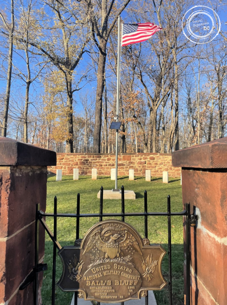
Today, the NOVA Parks (formerly the Northern Virginia Regional Park Authority) maintains much of the battlefield. Ongoing efforts have restored the land to a resemblance of its wartime appearance as an open meadow surrounded by woodlands atop a shale and sandstone bluff, some 100 feet above the Potomac River. The location is notable too as the site of the third smallest national cemetery in the United States.

Leesburg, Virginia, the county seat of Loudoun County, is a vibrant community with a historic downtown surrounded by residential districts. As an exurb of Washington, DC, the town’s population has grown steadily over the past several decades. When the Northern Virginia Regional Park Authority first acquired the battlefield land outside the cemetery in 1986, it likely preserved the land from the development that has enveloped much of Northern Virginia. Through the years, adding adjoining parcels brought the current park area to over 200 acres.
In 1861, as it is today, Leesburg was an important crossroads. The Confederates garrisoned a brigade at Leesburg commanded by Colonel Nathan “Shanks” Evans – a hero of the First Battle of Manassas. On October 17, 1862, Colonel Evans completed an unexpected withdrawal from Leesburg. His departure caught the attention of the overall Union commander, Major General George McClellan. However, word of his brigade’s return several days later did not reach McClellan.

Brigadier General Charles P. Stone
-Library of Congress, Prints and Photographs Division, Civil War Photographs
On October 20, 1861, McClellan ordered Brigadier General Charles P. Stone to verify if rebel troops were still in Leesburg. McClellan suggested a “slight demonstration” by Stone’s men might determine if the Confederates had returned. Stone ordered artillery fire and an infantry patrol, but there was no sign of Confederate troops. Finally, around dusk, he sent a detail of about 20 soldiers from the 15th Massachusetts Infantry Regiment across the river to establish if there was indeed a rebel presence in Leesburg.
Leading the effort was a newly commissioned officer, Captain Chase Philbrick. Captain Philbrick used three small boats to cross the rain-swollen Potomac River below Ball’s Bluff. Once on shore, he led his men up a steep, narrow trail to the top of the bluff. Marching about a mile through the darkness, Philbrick saw a row of trees he thought to be a confederate camp. Without further confirming his suspicions, the patrol returned across the river and relayed a report of an enemy encampment to General Stone.
This incorrect report would precipitate the Battle of Ball’s Bluff.
The Ball’s Bluff Battlefield Park is accessed on the aptly named Ball’s Bluff Road, which quickly transforms from a neighborhood street to a gravel road as it enters a wooded area. The Battlefield Park sign is assurance you are indeed in the right location.
Ball’s Bluff Road continues through the woods and terminates at the parking area. An orientation station adjacent to the parking lot provides a seating area and signage to familiarize the visitor with the early days of the Civil War, period life in Loudoun County and details on the origins of the battle.
From the orientation station an old road known as the Cart Path leads through the woods and into the open meadow towards the cemetery. This Cart Path was likely the route Captain Philbrick’s patrol took in search of the rebel camp. It is not hard to imagine what these soldiers could have felt as they made their way through the Virginia darkness. Being far from home, only recently in uniform and now in Confederate territory, it probably seemed rebel soldiers were behind every tree.
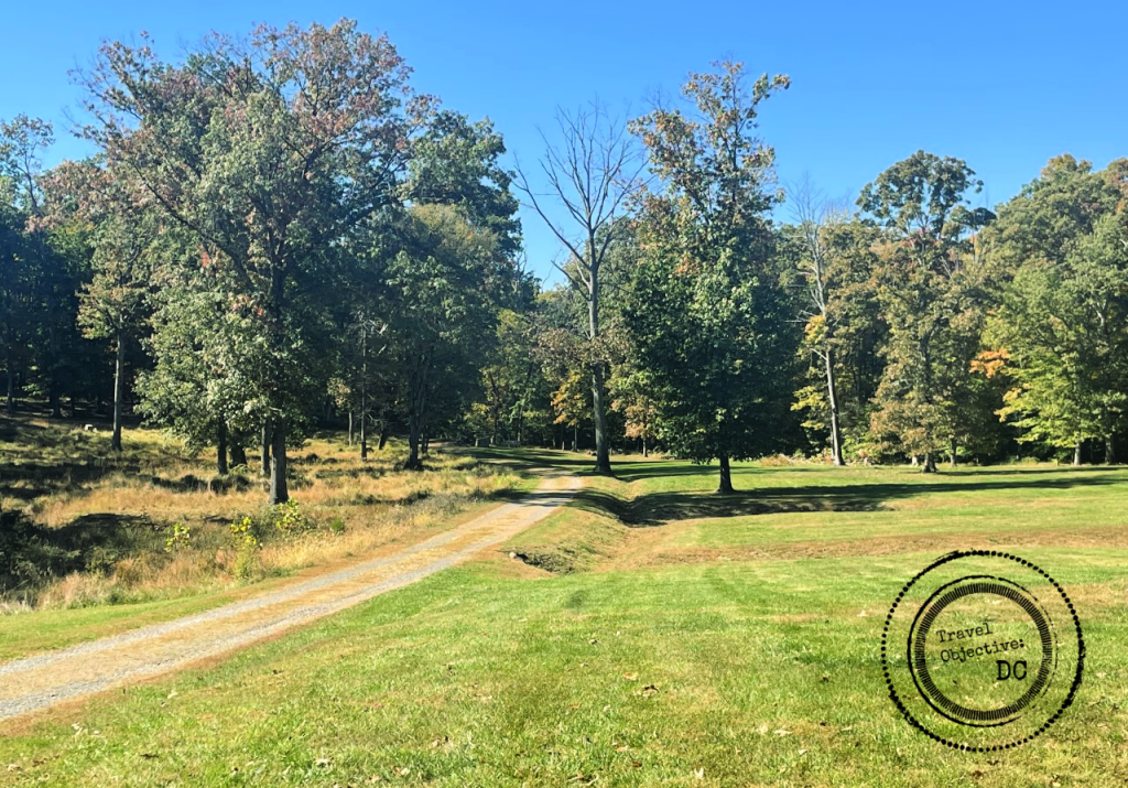
The Cart Path is only one of seven different trails that lace through the park. The main Battlefield Interpretive Trail is a .8 mile loop that circumvents the open field and provides access to principal historical features found in the park. Access the Interpretive Trail where it intersects the Cart Path at the entrance to the open meadow. Abundant signage along the trail provides background on the leaders and units who engaged at Ball’s Bluff.
As the trail approaches the edge of the bluff, it passes an overlook with vistas (depending on the foliage) over the river and into Maryland. From the overlook, a water tower in the distance marks Poolesville, Maryland where General Stone had his division headquarters. During the battle, Stone moved much closer to the river, but he would never have timely information on what was happening on Ball’s Bluff.
The Interpretive Trail then leads down to river’s shore. The climb down to (and back up from) the river can be a bit strenuous. Sturdy shoes are essential, but the trek is well worth it. At the river’s edge, the geographic challenge and its ramifications for the Union Army at Ball’s Bluff becomes quite apparent.
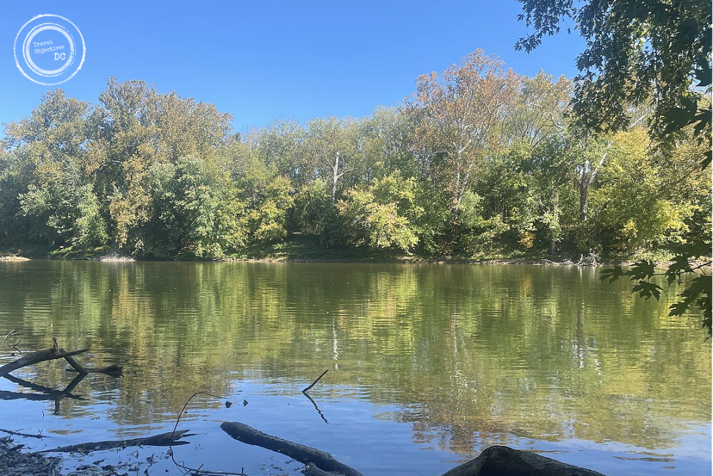
Harrison’s Island, viewed from the shore below Ball’s Bluff.
About 80 yards from the Virginia shoreline is Harrison’s Island. The island served as a staging area for Union forces moving to Ball’s Bluff. Union forces crossing the river here needed to rely on boats. Unfortunately for the Union, a courier’s inaccurate report to a battalion commander led to the use of the Harrison Island crossing rather than more shallow fording areas in the vicinity. Since the amphibious river crossing was unplanned, boats were in very short supply. Additionally, the Potomac River has swift moving currents not always visible on the surface adding difficulty to any river crossing.
After receiving Captain Philbrick’s report of an enemy camp, Stone ordered Colonel Charles Devens to prepare a raiding party. Devens and approximately 300 men from his 15th Massachusetts Infantry Regiment crossed the Potomac River early on the morning of October 21st.
At about 6:00 AM, Devens’ soldiers completed their river crossing and began climbing the same steep and narrow path as the Interpretive Trail up to Ball’s Bluff. They marched to the supposed camp location but soon discovered no rebel camp existed. While awaiting further direction, they encountered a Confederate patrol around 8:00 AM and the battle was soon underway. Skirmishing between Union and Confederate units continued through the morning.
Colonel (and U.S. Senator) Edward Baker
-Photograph ca 1861 by E. & H.T. Anthony

Throughout the afternoon, troops deployed in a rather disjointed fashion, further hindered by delayed and sometimes confused communications. The limited number of available boats and the narrow trail up and down the cliff also limited the movement of the Union soldiers.
Returning onto Ball’s Bluff, the trail winds away from the cliff’s edge and into the meadow. It passes a memorial marker to Colonel Edward Baker. After the initial reports of combat, General Stone selected Colonel Baker to take command of the Union forces engaged on Ball’s Bluff between 9:00 and 10:00 AM. Baker seemed a natural choice. He was a longtime friend of President Lincoln and a sitting United States Senator from Oregon. He had served in the Black Hawk War and commanded at the Brigade/Regiment level during the Mexican-American War. He also raised a volunteer regiment for Union service.
However, it would take Baker over four hours to make his way to Ball’s Bluff as he set about procuring additional boats to support the river crossing. Once on Ball’s Bluff, Baker displayed great nerve under fire. However, his maneuver plan failed to suppress the enemy and opportunities to take the initiative during the fight were lost. Baker was killed by enemy fire at about 5:00 PM.

The marker denoting the death of Colonel Edward Baker at Ball’s Bluff Battlefield Regional Park.
As evening was drawing in, Confederate units began surrounding the Union troops who were caught with their backs to the cliff. There were several attempts to break through the rebel lines towards the south, where the river crossing would be simpler, but they were unsuccessful.
Union troops began withdrawing down the cliff en masse. Several units valiantly slowed the Confederate advance, but the withdrawal became a rout. Panicked soldiers ran down the cliff. Some surrendered, others jumped into overcrowded boats or directly into the water. Rebels pursued the Union soldiers to the cliff’s edge keeping them under fire. Boats capsized and many Union soldiers drowned. The swift river currents carried the deceased away, some even beyond Washington to Mount Vernon.
Union losses at Ball’s Bluff were considerable: 223 soldiers were killed and 226 wounded. An additional 553 were captured or missing. Confederate losses were notably less, at about 36 men killed, 264 wounded and 2 missing.
Numerous accounts of the Union defeat at Ball’s Bluff were carried in newspapers across the North and the South. The coverage was extensive given Leesburg’s proximity to Washington and its occurrence only 90 days after the defeat at Manassas. The stinging defeat and high number of casualties, including the very popular Senator Baker, led to Congressmen and Senators forming the Joint Committee on the Conduct of the War to investigate several Union Army defeats, including Ball’s Bluff. After several hearings, the committee identified General Stone responsible for the loss. He was suspected of disloyalty and arrested. He was imprisoned without a trial and held for 189 days. Stone’s ordeal was a warning to other Union generals, who then became overly cautious in their decision making and planning of combat operations.
After the battle, Confederate troops removed their dead to Leesburg. A Union burial detail temporarily interred Union remains in a mass grave on the battlefield. Both sides returned many identified remains to their hometowns for burial. After four years, the U.S. Army established a national cemetery on Ball’s Bluff and buried the last 54 remains still interred on the battlefield. Within the cemetery’s stone wall, 25 markers are arrayed around a flagpole. Only one soldier is identified, Private James Allen of the 15th Massachusetts.
Gravestones surrounding the flag pole at the Ball’s Bluff National Cemetery

Today, Ball’s Bluff Battlefield is a National Historic Landmark. NOVA Parks strives to maintain the park as a natural setting, while at the same time providing the visitor with the means to understand the tragic events of the battle, their causes and their consequences. That work goes beyond the park’s signs, monuments and markers. A NOVA Parks sponsored organization, the Friends of Ball’s Bluff, provides volunteer guides to lead tours of the battlefield on weekends from April until November. Each year around the battle’s anniversary, the park hosts a heritage day with re-enactors and living history displays. An annual dinner recognizes the efforts of the Friends of Ball’s Bluff and their commitment to the park while raising funds for park restoration work.
There are many Civil War historical sites throughout the Washington DC area. However, in a short visit of only a few hours, Ball’s Bluff’s excellent conversation and interpretation of the battle provides valuable insights for anyone interested in a deeper understanding of the American Civil War. Coupled with other historical and cultural attractions in Loudoun County, a visit is well worth the time on anyone’s travel itinerary.
Route Recon
Ball’s Bluff Battlefield Regional Park is located on Ball’s Bluff Road in Leesburg, Virginia.
Please note there is no visitor center, restrooms or trashcans at Ball’s Bluff Battlefield Park.
Find more information about the park, park activities, hiking trails and the Friends of Ball’s Bluff at the NOVA Parks Website.
Command Reading List
These three resources provide extensive background on the Battle of Ball’s Bluff.
A Little Short of Boats; The Battles of Ball’s Bluff & Edwards Ferry – By James A. Morgan III
James Morgan was a local resident and volunteer guide at Ball’s Bluff Battlefield Park. His book examines McClellan’s strategy regarding Leesburg, the unique personalities among the leaders involved and the unintended consequences of many of the command decisions.
Battle at Ball’s Bluff – By Kim Bernard Holien
This book uses extensive historical resources and first person accounts to describe the battle. Published in 1985, it describes the rugged condition of the battlefield before the Northern Virginia Regional Park Authority assumed control of the land.
U.S. Army Staff Ride Guide, Battle of Ball’s Bluff – By Ted Ballard
The U.S. Army’s official staff ride guide provides an extensive account of the battle, leaders, and decision making, with an emphasis on the lessons learned in small unit actions, tactical planning and leadership.