Saratoga National Historical Park sits tucked up against the Hudson River along the rolling foothills of the Adirondack Mountains in upstate New York. The park preserves the sites of the First and Second Battles of Saratoga (also known as the Battle of Freeman’s Farm and the Battle of Bemis Heights respectively) fought in the autumn of 1777.
Saratoga is often described as the turning point of the American Revolution. For the first time, an entire British Army had surrendered to the Americans. The victory persuaded European powers, especially France, to come to support of the fledging nation fighting for its independence from Great Britain.
Like many battlefields, various stone markers and monuments dot these famous fields, commemorating leaders, units or events. On a small ridge sits a distinctive piece of American statuary, as unique as can be found on any American battlefield.
The statue marks the location where during the Second Battle of Saratoga, on October 7, 1777, the infamous Benedict Arnold was critically wounded in his left leg. He was leading his men in multiple charges against British and Hessian troops who were well defended behind tall, thick wooden redoubts.
It was on the last charge as Arnold and his men captured the redoubt that the final volley of retreating Hessians would find its mark. The bullets tore into Arnold’s left leg and killed his horse, which collapsed on and shattered the leg as the horse and rider dropped to the ground.

The painting Battle of Saratoga: General Arnold Wounded in the Attack on the Hessian Redoubt by Alonzo Chappel, 1860
Arnold’s contributions at Saratoga would secure an important American victory, yet lead him down the path to treachery.
In the United States, the name Benedict Arnold is still synonymous with traitor. Yet this was not always true.
Arnold was born in Connecticut, the son of a successful barrel maker. He grew up living a comfortable life in Colonial America. At a young age, Arnold apprenticed in a relative’s apothecary shop. He later became a shipper and merchant, occupations where he could seek adventure and profits at the same time.
As the colonies moved closer to revolution, Arnold became a colonial militia leader in Connecticut. He repeatedly demonstrated tremendous courage in battle, an adroit grasp of tactics and outstanding military leadership. Arnold, along with Ethan Allen, captured Fort Ticonderoga in 1775. He led a colonial force in the attacks on Montreal and Quebec, commanded a fleet of ships on Lake Champlain and relieved a British siege of Fort Stanwix in Western New York. Arnold would receive tributes and promotions for his actions.
Benedict Arnold, depicted as a colonel by English artist Thomas Hart, 1776

Yet Arnold was also a very difficult person, vain, distrustful of others, and easily offended. He especially chafed when others took or received the credit he thought he deserved.
At Saratoga he was often in conflict with his more cautionary commander, Horatio Gates. After the battle, Gates took credit for Arnold’s actions, which enraged Arnold. Arnold’s business was also struggling and he resented the promotion of other officers over him.
After a long, difficult and painful convalescence (he never regained full use of his leg), Arnold was placed in command of American forces around Philadelphia. There he met and eventually married the daughter of a prominent loyalist family. It was in Philadelphia where Arnold began to communicate with British officials regarding switching sides.
In 1780, Arnold was named the commander of the U.S. fortifications at West Point, an important stronghold on the Hudson River. Arnold arranged for the surrender of West Point to the British in exchange for money and a commission in the British Army, negotiating the terms with his British interlocutor, Major John André.
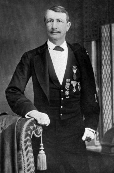
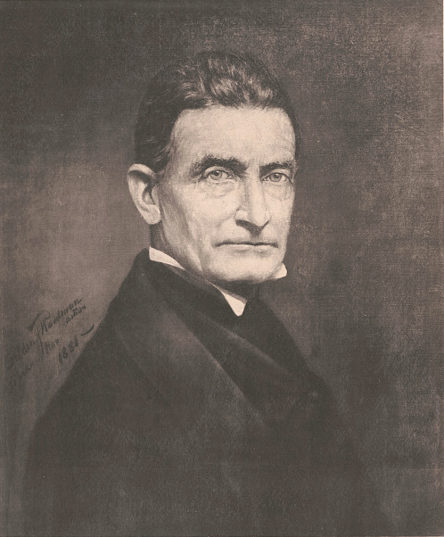
John Watts de Peyster, scion of a prominent New York family, was an author, commentator on military affairs and Adjutant General of the New York Militia.
After a meeting with Arnold, André was captured by New York militiamen. While André was searched, the surrender terms and other documents were discovered in his boot. As he was not in uniform, André was arrested and later hung as a spy. With his treachery exposed, Arnold fled to New York City. While he received a major general’s commission, his British superior, Sir Henry Clinton had little trust in Arnold. He did not have many opportunities for success on the battlefield. After the final victory at Yorktown, Arnold and his family moved to London.
Arnold revived his merchant business after the war with mixed results. Although he had established good relationships with King George III and members of the British aristocracy, Arnold was not highly regarded in England, and he remained despised in the United States.
He died in London in 1801, a rather bitter man.
Nevertheless, a century later, a New York military and community leader named John Watts de Peyster commissioned a monument commemorating Arnold’s actions on the Saratoga battlefield. de Peyster was the author of several works of military history, including two books on the Battle of Saratoga.
The Boot Monument, commissioned by John Watts de Peyster and sculpted by George Edwin Bissell.

de Peyster admired the courage Arnold displayed at Saratoga and its contributions to the American victory, and the subsequent assistance to the cause the victory brought about. He believed Arnold’s actions deserved recognition. de Peyster collaborated with a prominent sculptor named George Edwin Bissell to create a statue recognizing Arnold’s actions, but not his treachery.
Approaching the statue, known as the Boot Monument, the four foot high white marble sculpture almost resembles a grave marker especially as it is enclosed by a black iron fence. The front of the monument is really rather simple. It bears no inscriptions, only simple yet expressive imagery. A rider’s boot, with the toe pointing left (to symbolize Arnold’s left leg), topped by a major general’s fringed epaulet, further crowned by a laurel wreath. The vertically aligned images all seem to hang from a downward pointed howitzer.
On the reverse of the monument is this inscription:
Erected 1887 By
JOHN WATTS de PEYSTER
Brev: Maj: Gen: S.N.Y.
2nd V. Pres’t Saratoga Mon’t Ass’t’n:
In memory of
the “most brilliant soldier” of the
Continental Army
who was desperately wounded
on this spot the sally port of
BURGOYNES GREAT WESTERN REDOUBT
7th October, 1777
winning for his countrymen
the decisive battle of the
American Revolution
and for himself the rank of
Major General.
While Arnold is not mentioned anywhere on the statue, a nearby interpretive sign summarizes his story, so there is no question to whom the phrase “the most brilliant soldier of the Continental Army” refers. It is worth noting that Arnold was already a major general at the time of the battle. He was however, promoted to a more senior status as a result of his conduct at Saratoga.

The Saratoga Battle Monument in the village of Victory, New York
Perhaps de Peyster’s interest in recognizing Arnold with a separate statue stems from his work as part of the Saratoga Monument Association (referred to as “Saratoga Mon’t Ass’t’n” on the inscription), which purposefully snubbed Arnold in another monument.
To mark the Battle of Saratoga’s centennial in 1877, the Saratoga Monument Association, a private group, raised funds to build a prominent monument near the battlefield.
Completed in 1883, the Saratoga Battle Monument is a 155 foot high obelisk made of dark granite. It is located in the nearby village of Victory, New York.
The empty statue niche on the Saratoga Battle Monument.

The monument has a door on each of its four sides, and above each door is a niche for a statue. Three of the niches contain statues of the senior commanders at Saratoga: General Horatio Gates, General Philip Schuyler and Colonel Daniel Morgan. The fourth niche, facing south toward the battlefield, is purposefully empty. It is where a statue of Benedict Arnold would have been placed had he stayed true to the cause.
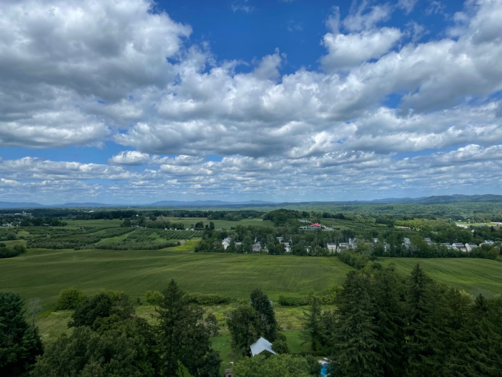
When the monument is open, visitors can climb the 188 stairs to the top and take in the very picturesque countryside with views of local farms, rolling hills and the Adirondack Mountains in the distance. Along the way, there are sixteen bas relief plaques cast in bronze with scenes from the time of the battle along with stained glass windows and mosaic tiled floors.

The bas relief sculpture of the wounding of Benedict Arnold inside the Saratoga Battle Monument.
The Saratoga battlefield and Monument are only two of five sites comprising the Saratoga National Historical Park. Other venues include Victory Woods, where the British Army made its final encampment, the Saratoga Surrender Site, and the Philip Schuyler mansion. (Schuyler was a New York patrician who commanded the Continental forces opposing Burgoyne prior to Gates. He is probably best known today as Alexander Hamilton’s father-in-law). The park recently completed a $6 million dollar improvement project that added interpretive signage, tactile maps and other objects, along with upgraded roadways and trailheads.
As the national mark’s the 250th anniversary of the American revolution, new generations of historians, students and visitors will research and learn about the early American Patriots. They will discover how complex these men and women were. Perhaps one of the most complex was Benedict Arnold. Although he eventually chose a dishonorable path, he fought very bravely for the cause of independence at a critical time of the Revolutionary War. de Peyster’s statue reminds us of this Arnold — an Arnold that is too important to be forgotten or ignored.
Route Recon
Start your trip to the Saratoga National Historical Park at the park’s Visitor Center where you will find information about the battle, the park’s various venues, upcoming programs and weather advisories.
The Visitor’s Center is located at 648 New York State Route 32, Stillwater, NY 12170.
The park is approximately 40 miles north of Albany, NY and 14 miles southeast of Saratoga Springs, NY.
More detailed directions are available here.
The park is open year-round, with the exception of several holidays. Some park features are only open seasonally. Check the Saratoga National Historical Park website for more information about seasonal operating hours.
There is a one-way, 10-mile road circumventing the battlefield area. The road has ten tour stops at significant places in the battlefield. The Boot Monument is located at Stop 7.
Mess Call
Fortify yourself for your day of exploration at the Saratoga National Historical Park at Mama Bear’s Diner (formerly Sweeney’s) in Schuylerville, NY. Mama Bear’s serves hearty breakfast and generous sandwiches for lunch in a modern yet homey setting. The eatery recently changed ownership with a long-time server taking ownership. She is continuing the traditions of generous portions that Sweeney’s had established while adding a focus on sourcing more ingredients from local farms.
Mama Bear’s Diner is located at 106 Broad Street, Schuylerville, NY, 12871.
Open Wednesday through Sunday from 7:00 AM to 2:00 PM.
Command Reading
Saratoga: A Military History of the Decisive Campaign of the American Revolution
Author John Lauder drew upon his years of experience as a researcher and historian for the National Park Service (he developed the interpretation plan for Saratoga National Historical Park) to write a comprehensive yet readable history of British General John Burgoyne’s Albany Campaign of 1777. Lauder’s work carefully examines the strategic and tactical aspects of the campaign along with the parallel political machinations which shaped the campaign and the Americans’ defensive response. Lauder thoroughly examines Benedict Arnold’s actions, from his participation in the 1775 attack on Quebec to his command of the fleet on Lake Champlain to his leadership at Saratoga.